Georgia and Florida
Date:
1763
Reference:
CO 700/GEORGIA13
Creator:
Colonial Office, Commonwealth and Foreign and Commonwealth Offices, Empire Marketing Board, and related bodies
Catalogue context:
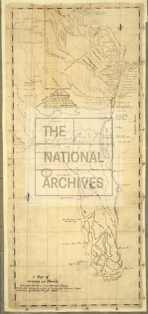
A Map of Georgia and Florida. Taken from the latest and most accurate surveys. Delineated and drawn by a scale of 69 English miles to a degree of Latitude by Thomas Wright, 1763. MS. About 19 miles to 1 inch.
Categories:
Maps and plans
Subjects:
Americas; Europe and Russia; International; Maps and plans
Topics:
International trade and affairs; Land and buildings
Period:
Empire And Industry
Copyright information:
Copyright clearance for publication is not required, except in the case of documents in third-party copyright.
Usage terms:
https://www.nationalarchives.gov.uk/documents/information-management/use-of-tna-materials.pdf