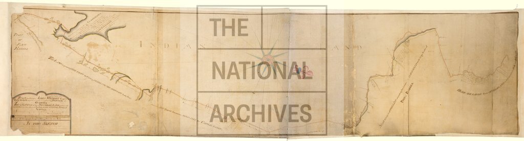
Boundary Line between the Province of Georgia and the Creek Indian Nation
Date:
1769
Reference:
CO 700/GEORGIA14
Creator:
Colonial Office, Commonwealth and Foreign and Commonwealth Offices, Empire Marketing Board, and related bodies
Catalogue context:
Sketch of the Boundary Line as it is now mark'd between the afforesaid Province [of Georgia] and the Creek Indian Nation. By Saml. Savery, D. Surveyor, 14th January, 1769. MS. 4 miles to 1 inch.
Categories:
Maps and plans
Subjects:
Americas; Europe and Russia; International; Maps and plans
Topics:
International trade and affairs; Land and buildings
Period:
Empire And Industry
Copyright information:
Copyright clearance for publication is not required, except in the case of documents in third-party copyright.
Usage terms:
https://www.nationalarchives.gov.uk/documents/information-management/use-of-tna-materials.pdf