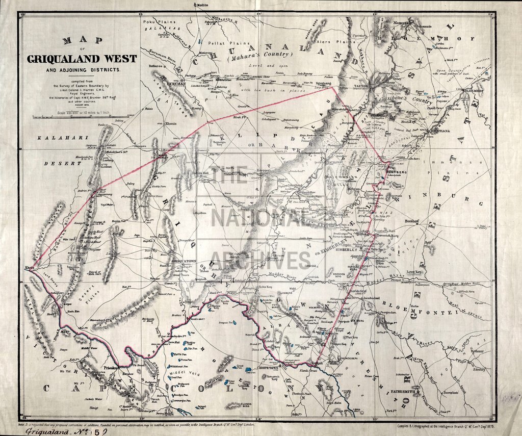
Griqualand West
Date:
1879
Reference:
CO 700/GriqualandWest5 (1)
Creator:
Colonial Office, Commonwealth and Foreign and Commonwealth Offices, Empire Marketing Board, and related bodies
Catalogue context:
Map of Griqualand West and adjoining Districts. Compiled from the Survey of Eastern Boundary by Lieut.-Colonel C. Warren, C.M.G., R.E., the Itineraries of Capt. H. M. E. Brunker, and other sources, August, 1879. 10 miles to 1 inch. Author, Publisher, &c.: War Office, London
Categories:
Maps and plans
Subjects:
Africa; Armed Forces (General Administration); Army; International; Maps and plans
Topics:
International trade and affairs; Land and buildings; Military and war
Period:
Victorians
Copyright information:
Copyright clearance for publication is not required, except in the case of documents in third-party copyright.
Usage terms:
https://www.nationalarchives.gov.uk/documents/information-management/use-of-tna-materials.pdf