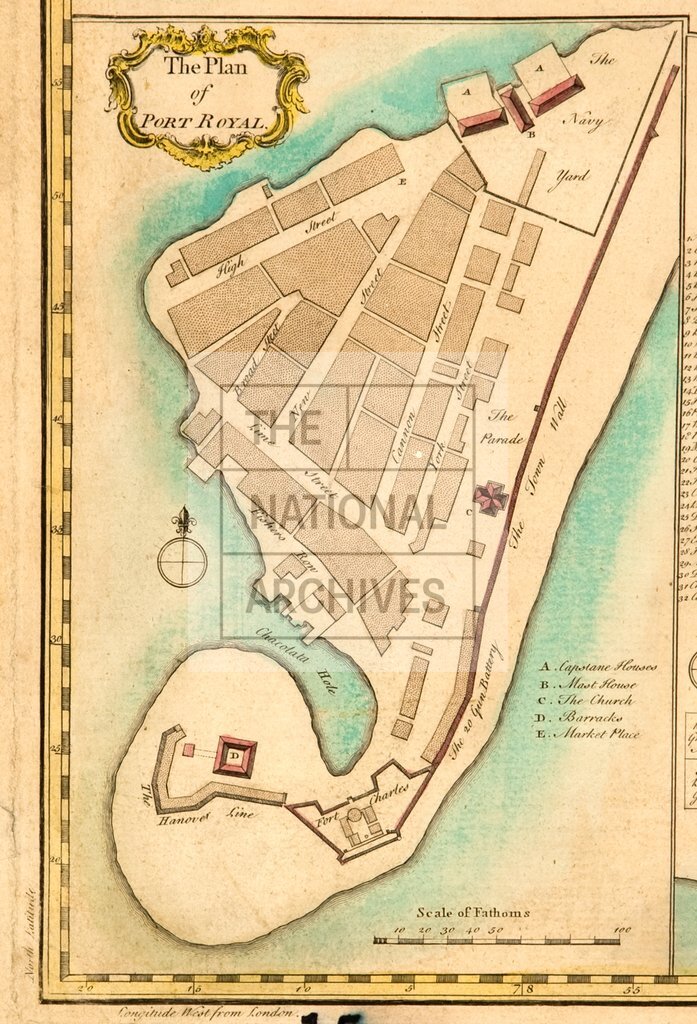
Jamaica (inset detail, Port Royal)
Date:
1753
Reference:
CO 700/JAMAICA15
Creator:
Colonial Office, Commonwealth and Foreign and Commonwealth Offices, Empire Marketing Board, and related bodies
Catalogue context:
A map of the Island of Jamaica with exact plans of the Towns of Port Royal and Kingston. By Archibald Bontein, H.M.'s Chief Engineer in ye said Island during the late war. [London]. About 6 miles to 1 inch.
Categories:
Maps and plans; Overseas
Subjects:
Caribbean; International; Maps and plans; Navy
Topics:
International trade and affairs; Land and buildings; Military and war
Period:
Empire And Industry
Places:
Caribbean
Copyright information:
Copyright clearance for publication is not required, except in the case of documents in third-party copyright.
Usage terms:
https://www.nationalarchives.gov.uk/documents/information-management/use-of-tna-materials.pdf