North Borneo
Date:
1878
Reference:
CO 700/LabuanandBorneo5
Creator:
Colonial Office, Commonwealth and Foreign and Commonwealth Offices, Empire Marketing Board, and related bodies
Catalogue context:
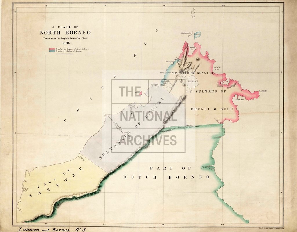
A Chart of North Borneo traced from the English Admiralty Chart, 1878. [Showing Territory granted by Sultans of Sulu and Brunei.] About 25 miles to 1 inch. Author, Publisher, &c.: [Official] London
Categories:
Maps and plans; Overseas
Subjects:
Armed Forces (General Administration); Asia; International; Maps and plans; Navy
Topics:
International trade and affairs; Land and buildings; Military and war
Period:
Victorians
Places:
Borneo
Copyright information:
Copyright clearance for publication is not required, except in the case of documents in third-party copyright.
Usage terms:
https://www.nationalarchives.gov.uk/documents/information-management/use-of-tna-materials.pdf