Townships surveyed in Manitoba
Date:
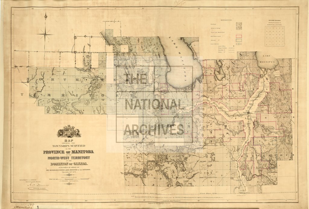
1874
Reference:
CO 700/MANITOBA1
Creator:
Colonial Office, Commonwealth and Foreign and Commonwealth Offices, Empire Marketing Board, and related bodies
Catalogue context:
Map shewing the Townships surveyed in the Province of Manitoba and North-West Territory in the Dominion of Canada. Published by order of the Minister of the Interior, December 31st, 1874. Engraved by H. H. Lloyd and Co., New York. 6 miles to 1 inch. Author, Publisher, &c.: Official, [Ottawa].
Categories:
Maps and plans
Subjects:
Americas; International; Maps and plans
Topics:
International trade and affairs; Land and buildings
Period:
Victorians
Copyright information:
Copyright clearance for publication is not required, except in the case of documents in third-party copyright.
Usage terms:
https://www.nationalarchives.gov.uk/documents/information-management/use-of-tna-materials.pdf