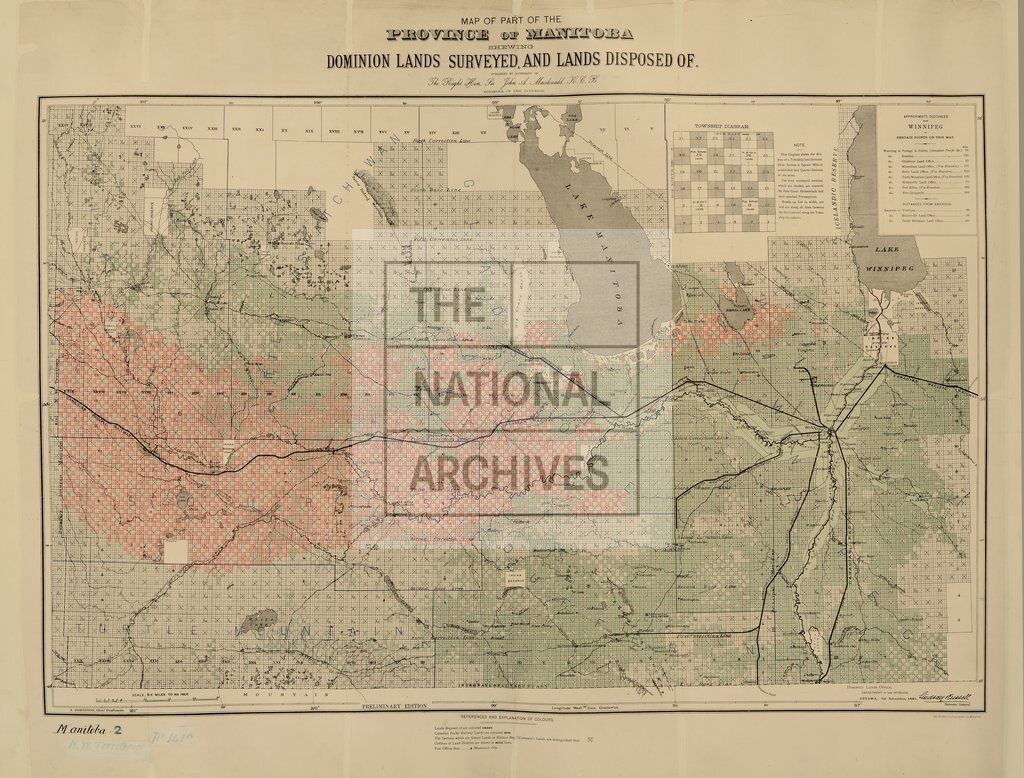
Manitoba, showing Lands surveyed and Lands disposed of
Date:
1881
Reference:
CO 700/MANITOBA2
Creator:
Colonial Office, Commonwealth and Foreign and Commonwealth Offices, Empire Marketing Board, and related bodies
Catalogue context:
Map of part of the Province of Manitoba, shewing Dominion Lands surveyed and Lands disposed of. Published by authority of the Minister of the Interior. Ottawa, 1st November, 1881. Lindsay Russell, Surveyor-General. 6 miles to 1 inch. Author, Publisher, &c.: Official, Ottawa.,
Categories:
Maps and plans
Subjects:
International; Maps and plans
Topics:
International trade and affairs; Land and buildings
Period:
Victorians
Copyright information:
Copyright clearance for publication is not required, except in the case of documents in third-party copyright.
Usage terms:
https://www.nationalarchives.gov.uk/documents/information-management/use-of-tna-materials.pdf