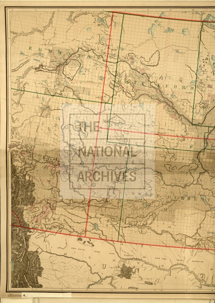
Manitoba and part of the North-West Territories of Canada, showing Dominion Land Surveys
Date:
1885
Reference:
CO 700/MANITOBA4 (1)
Creator:
Colonial Office, Commonwealth and Foreign and Commonwealth Offices, Empire Marketing Board, and related bodies
Catalogue context:
Map of the Province of Manitoba and part of the North-West Territories of Canada, shewing Dominion Land Surveys to August 31st, 1885. Compiled and drawn under the direction of E. Deville, Surveyor-General. Published by order of the Minister of the Interior, Ottawa. About 12½ miles to 1 inch.
Categories:
Maps and plans; Overseas
Subjects:
Americas; International; Maps and plans
Topics:
International trade and affairs; Land and buildings
Period:
Victorians
Places:
Canada
Copyright information:
Copyright clearance for publication is not required, except in the case of documents in third-party copyright.
Usage terms:
https://www.nationalarchives.gov.uk/documents/information-management/use-of-tna-materials.pdf