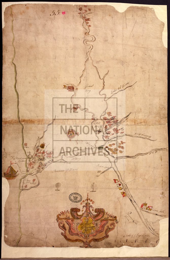
Piscataqua River, New England
Date:
1708
Reference:
CO 700/NewHampshire9
Creator:
Colonial Office, Commonwealth and Foreign and Commonwealth Offices, Empire Marketing Board, and related bodies
Catalogue context:
A Map of Piscataqua River in New England, 1708. MS. 1 mile to 1 inch.
Categories:
Maps and plans
Subjects:
International
Topics:
International trade and affairs; Land and buildings
Period:
Early Modern
Places:
England; Great Britain
Copyright information:
Copyright clearance for publication is not required, except in the case of documents in third-party copyright.
Usage terms:
https://www.nationalarchives.gov.uk/documents/information-management/use-of-tna-materials.pdf