Reuss and Browne's map of New South Wales and part of Queensland
Date:
1862
Reference:
CO 700/NewSouthWales39
Creator:
Colonial Office, Commonwealth and Foreign and Commonwealth Offices, Empire Marketing Board, and related bodies
Catalogue context:
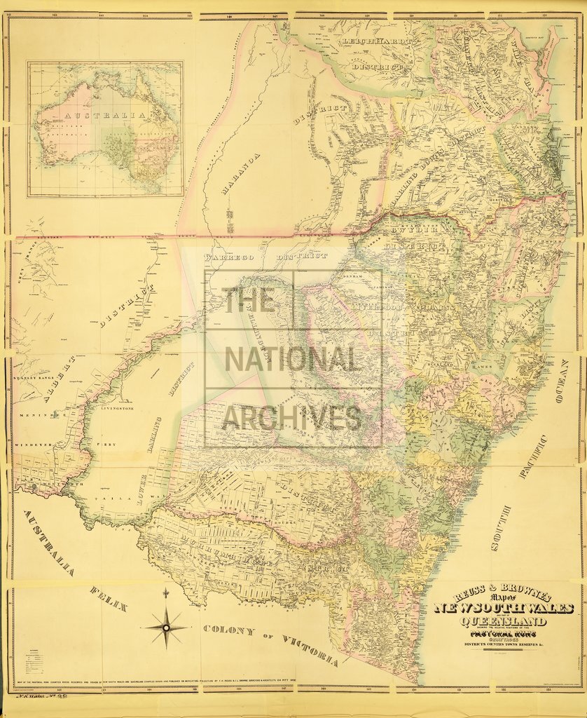
Reuss and Browne's map of New South Wales and part of Queensland, showing the relative positions of the pastoral runs, squattages, districts, counties, towns, reserves, etc. Compiled, drawn and published by F. H. Reuss and J. L. Browne, Sydney. About 18 miles to 1 inch.
Categories:
Maps and plans
Subjects:
Australia and Pacific; International; Maps and plans
Topics:
International trade and affairs; Land and buildings
Period:
Victorians
Places:
Great Britain; Wales
Copyright information:
Copyright clearance for publication is not required, except in the case of documents in third-party copyright.
Usage terms:
https://www.nationalarchives.gov.uk/documents/information-management/use-of-tna-materials.pdf