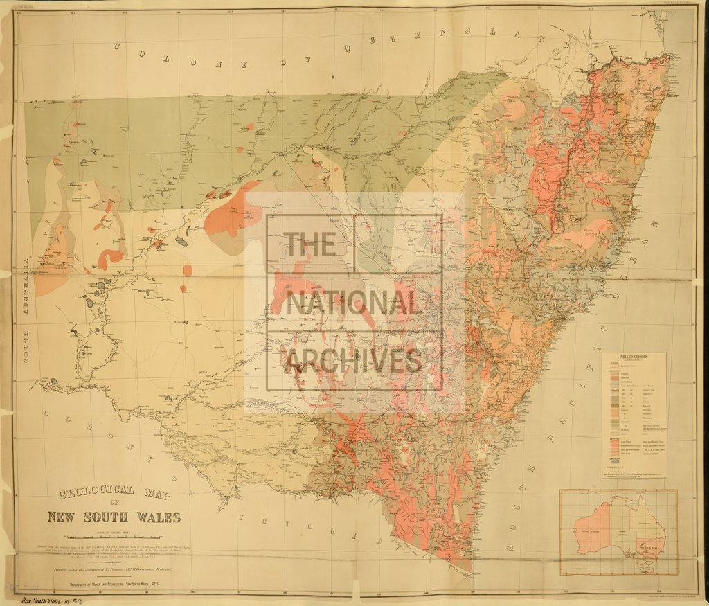
Geological map of New South Wales
Date:
1893
Reference:
CO 700/NewSouthWales52
Creator:
Colonial Office, Commonwealth and Foreign and Commonwealth Offices, Empire Marketing Board, and related bodies
Catalogue context:
Geological map of New South Wales. Prepared under the direction of E. F. Pittman, A.R.S.M., Government Geologist, Department of Mines and Agriculture, N.S.W., 1893. 16 miles to 1 inch.
Categories:
Maps and plans
Subjects:
Australia and Pacific; Farming; International; Maps and plans
Topics:
Agriculture and environment; International trade and affairs; Land and buildings
Period:
Victorians
Places:
Great Britain; Wales
Copyright information:
Copyright clearance for publication is not required, except in the case of documents in third-party copyright.
Usage terms:
https://www.nationalarchives.gov.uk/documents/information-management/use-of-tna-materials.pdf