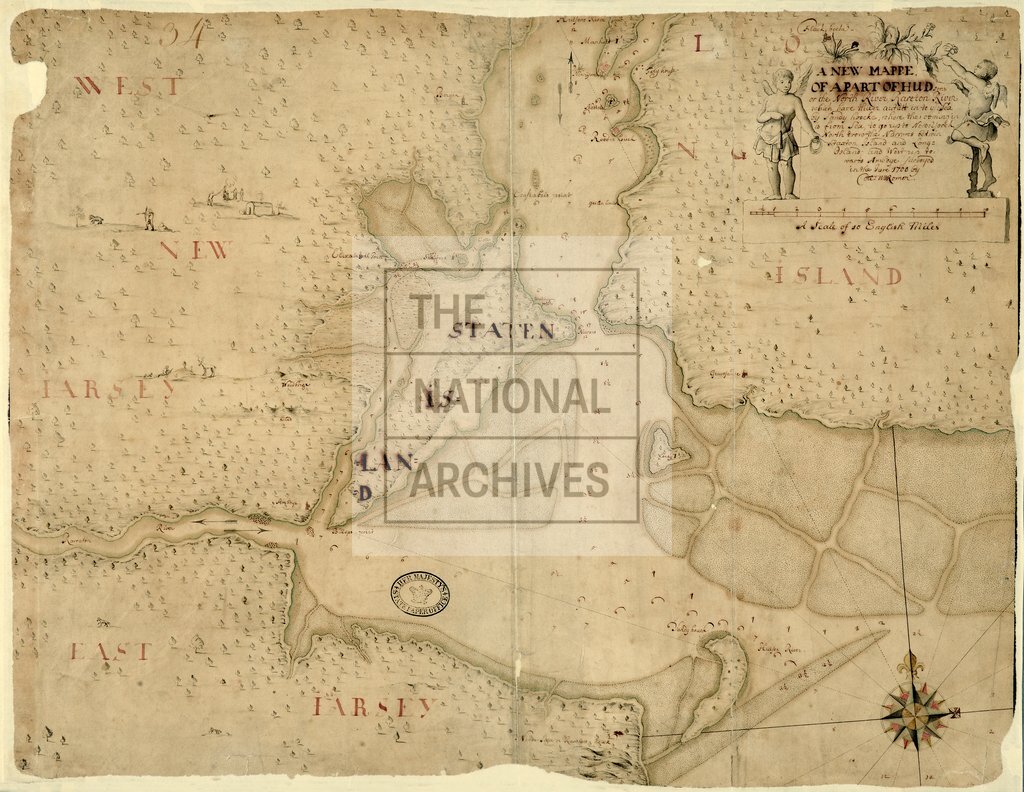
Hudson River and Rareton River, to the Sea between Staten Island and Long Island, New York, by Col William Romer
Date:
1700
Reference:
CO 700/NewYork13B
Creator:
Colonial Office, Commonwealth and Foreign and Commonwealth Offices, Empire Marketing Board, and related bodies
Catalogue context:
A new Mappe of a Part of the Hudsons or the North River Rareton River, which have thieir outlett in to the Sea by Sandy Noocke, where the coming in as from Sea to go up to New York North from the Narrows between Staaten Island and Long Island, and West up towards Amboye, surveyed in 1700 by Col William Romer. 1 inch to 2 miles
Categories:
Maps and plans; Overseas
Subjects:
Americas; International; Maps and plans
Topics:
International trade and affairs; Land and buildings
Period:
Early Modern
Places:
Americas
Copyright information:
Copyright clearance for publication is not required, except in the case of documents in third-party copyright.
Usage terms:
https://www.nationalarchives.gov.uk/documents/information-management/use-of-tna-materials.pdf