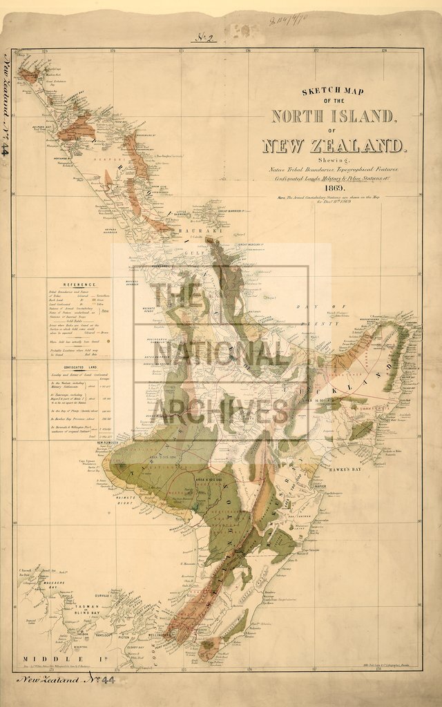
Sketch map of North Island off New Zealand
Date:
1869
Reference:
CO 700/NewZealand44
Creator:
Colonial Office, Commonwealth and Foreign and Commonwealth Offices, Empire Marketing Board, and related bodies
Catalogue context:
Sketch map of the North Island of New Zealand. Shewing Native Tribal Boundaries, Topographical features, confiscated lands, Military and Police Stations, etc, 1869. Drawn by T.W. Palin, Defence Office, Wellington. 1 inch to about 18 miles
Categories:
Maps and plans; Overseas
Subjects:
International
Topics:
International trade and affairs; Land and buildings
Period:
Victorians
Places:
New Zealand
Copyright information:
Copyright clearance for publication is not required, except in the case of documents in third-party copyright.
Usage terms:
https://www.nationalarchives.gov.uk/documents/information-management/use-of-tna-materials.pdf