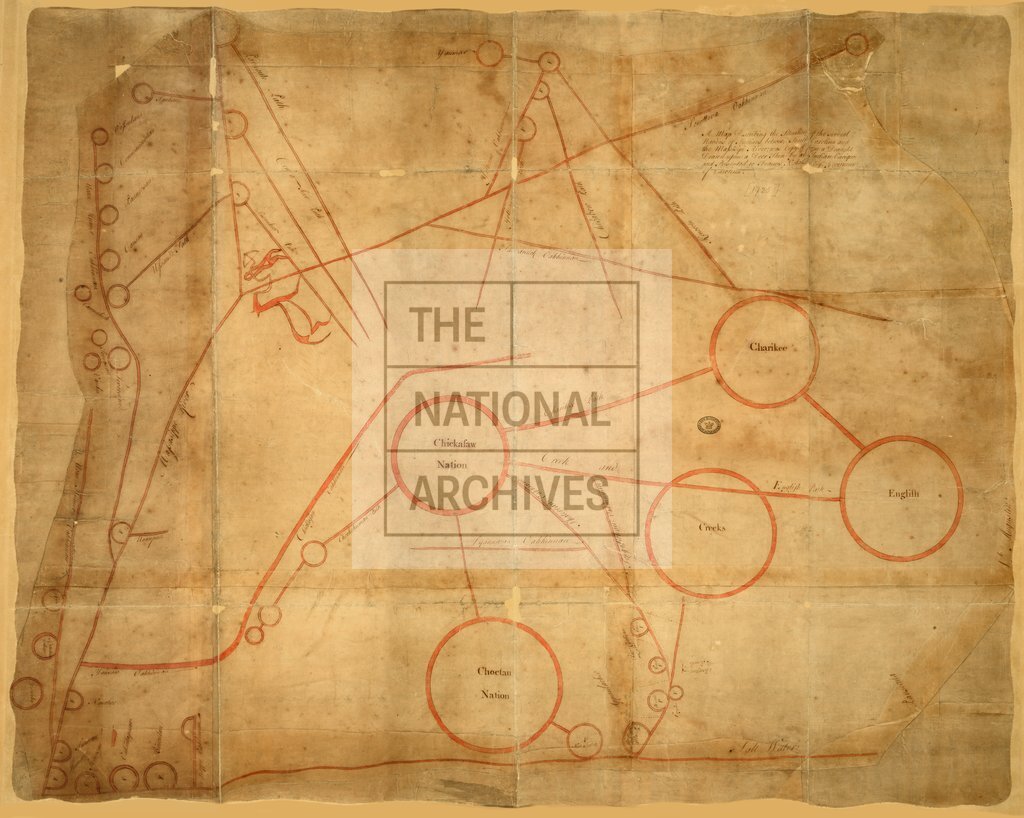
Situation of Native American nations between South Carolina and the Mississippi River, c1725
Date:
1721-1725
Reference:
CO 700/NorthAmericanColoniesGeneral6 (2)
Creator:
Colonial Office, Commonwealth and Foreign and Commonwealth Offices, Empire Marketing Board, and related bodies
Catalogue context:
Two similar maps showing the distribution of Native American nations between South Carolina and the Mississippi River. (Described at item level)
Categories:
Maps and plans
Subjects:
International
Topics:
International trade and affairs; Land and buildings
Period:
Early Modern
Copyright information:
Copyright clearance for publication is not required, except in the case of documents in third-party copyright.
Usage terms:
https://www.nationalarchives.gov.uk/documents/information-management/use-of-tna-materials.pdf