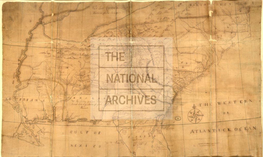
North America from Cape Charles to the Mouth of the River Mississippi c1730
Date:
1730
Reference:
CO 700/NorthAmericanColoniesGeneral7
Creator:
Colonial Office, Commonwealth and Foreign and Commonwealth Offices, Empire Marketing Board, and related bodies
Catalogue context:
Map of part of North America from Cape Charles to the Mouth of the River Mississipi. MS. 20 miles to 1 inch.
Categories:
Maps and plans
Subjects:
Americas; International; Maps and plans
Topics:
International trade and affairs; Land and buildings
Period:
Early Modern
Copyright information:
Copyright clearance for publication is not required, except in the case of documents in third-party copyright.
Usage terms:
https://www.nationalarchives.gov.uk/documents/information-management/use-of-tna-materials.pdf