Northwest Territories and Manitoba
Date:
1883
Reference:
CO 700/NorthWestTerritoriesandYukon3
Creator:
Colonial Office, Commonwealth and Foreign and Commonwealth Offices, Empire Marketing Board, and related bodies
Catalogue context:
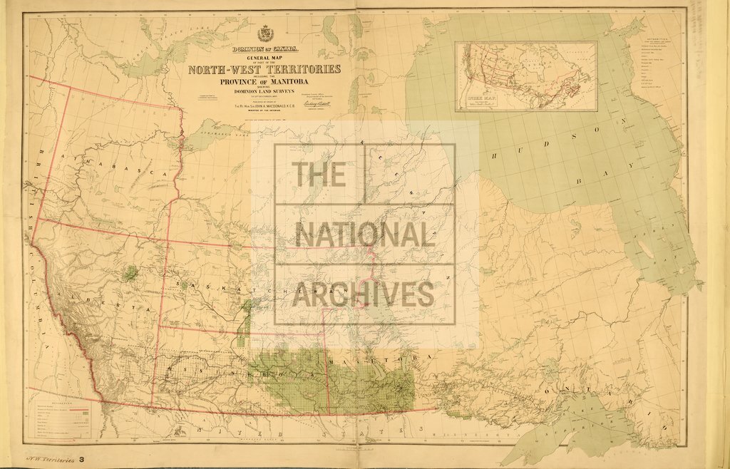
General Map of part of the North-West Territories, including the Province of Manitoba, shewing Dominion Lands Surveys to 31st December, 1882. Compiled and drawn by J. Johnston, Chief Draftsman. Published by order of the Minister of the Interior, Ottawa. Additions and corrections to 15th March, 1883. About 40 miles to 1 inch.
Categories:
Maps and plans
Subjects:
International; Maps and plans
Topics:
International trade and affairs; Land and buildings
Period:
Victorians
Copyright information:
Copyright clearance for publication is not required, except in the case of documents in third-party copyright.
Usage terms:
https://www.nationalarchives.gov.uk/documents/information-management/use-of-tna-materials.pdf