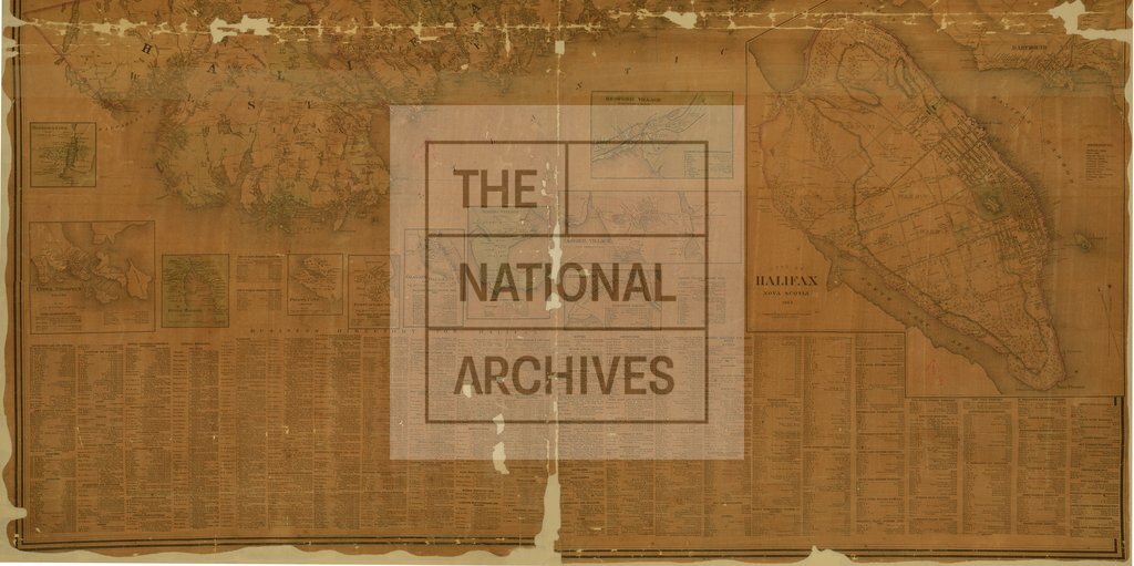
Topographical Township Map of Halifax County, Nova Scotia
Date:
1864
Reference:
CO 700/NovaScotia73B (bottom half)
Creator:
Colonial Office, Commonwealth and Foreign and Commonwealth Offices, Empire Marketing Board, and related bodies
Catalogue context:
Topographical Township Map of Halifax County, Nova Scotia. From actual surveys, drawn and engraved under the direction of H.F. Walling. Published by A.F. Church & Co. Halifax. With numerous insets and Business directories, 500 rods to 1 inch.
Categories:
Maps and plans
Subjects:
International; Maps and plans
Topics:
International trade and affairs; Land and buildings
Period:
Victorians
Copyright information:
Copyright clearance for publication is not required, except in the case of documents in third-party copyright.
Usage terms:
https://www.nationalarchives.gov.uk/documents/information-management/use-of-tna-materials.pdf