Prince Edward Island.
Date:
1868
Reference:
CO 700/PrinceEdwardIsland9
Creator:
Colonial Office, Commonwealth and Foreign and Commonwealth Offices, Empire Marketing Board, and related bodies
Catalogue context:
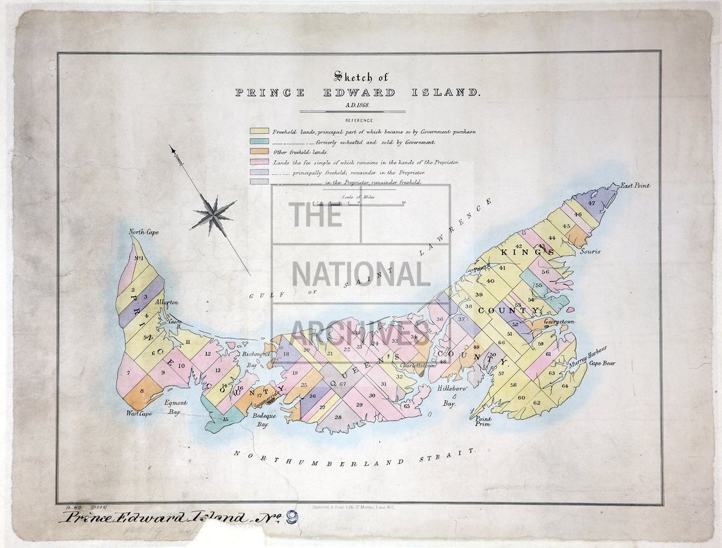
Sketch of Prince Edward Island. 1868. Showing freehold and other lands. 1 inch to about 9 miles
Categories:
Maps and plans
Subjects:
International; Maps and plans
Topics:
International trade and affairs; Land and buildings
Period:
Victorians
Copyright information:
Copyright clearance for publication is not required, except in the case of documents in third-party copyright.
Usage terms:
https://www.nationalarchives.gov.uk/documents/information-management/use-of-tna-materials.pdf