Rhode Island
Date:
1720
Reference:
CO 700/RhodeIsland1 (1)
Creator:
Colonial Office, Commonwealth and Foreign and Commonwealth Offices, Empire Marketing Board, and related bodies
Catalogue context:
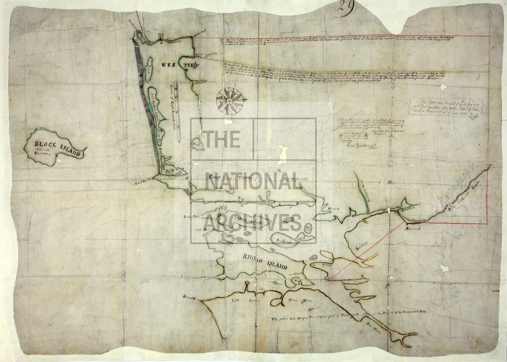
A true and exact map or chart of ye Colony Rhoad Island and Providence Plantation, New England in America. Surveyed and made to order of the Government in 1720. By John Munford, Sworn Surveyor. Approved and allowed by the Generall Assembly sitting at Newport, 19 June 1720. Samuel Cranston, Governor. MS. 1 inch to 2 miles
Categories:
Maps and plans
Subjects:
Americas; International; Maps and plans
Topics:
International trade and affairs; Land and buildings
Period:
Early Modern
Copyright information:
Copyright clearance for publication is not required, except in the case of documents in third-party copyright.
Usage terms:
https://www.nationalarchives.gov.uk/documents/information-management/use-of-tna-materials.pdf