Rhode Island
Date:
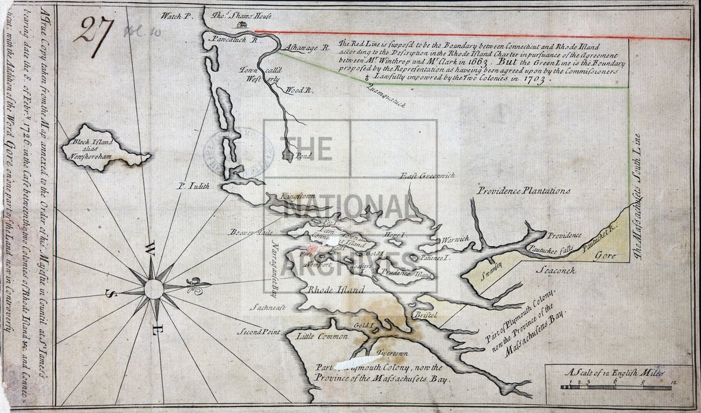
1726
Reference:
CO 700/RhodeIsland2
Creator:
Colonial Office, Commonwealth and Foreign and Commonwealth Offices, Empire Marketing Board, and related bodies
Catalogue context:
A true copy taken from the map annexed to the Order of his Majestie in Council at St James's, bearing date 8 Feb 1726, in the Case between the two Colonies of Rhode Island, etc., and Connecticut; with the addition of the Word GORE on one part of the land now in Controversy. 1 inch to 6 miles
Categories:
Maps and plans
Subjects:
Americas; International; Maps and plans
Topics:
International trade and affairs; Land and buildings
Period:
Early Modern
Copyright information:
Copyright clearance for publication is not required, except in the case of documents in third-party copyright.
Usage terms:
https://www.nationalarchives.gov.uk/documents/information-management/use-of-tna-materials.pdf