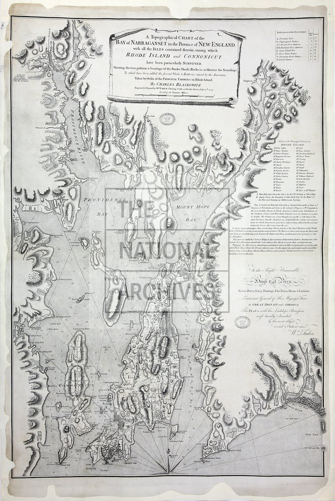
A Topographical Chart of the Bay of Narraganset (mono)
Date:
1777
Reference:
CO 700/RhodeIsland7
Creator:
Colonial Office, Commonwealth and Foreign and Commonwealth Offices, Empire Marketing Board, and related bodies
Catalogue context:
A Topographical Chart of the Bay of Narraganset in the Province of New England, with all the Isles contained therein, among which Rhode Island and Connonicut have been particularly surveyed...Taken by order of the principal farmers on Rhode Island by Charles Blaskowitz. Engraved and printed for William Faden, London, 22 July 1777. 1¼ inches to 1 mile.
Categories:
Maps and plans
Subjects:
Americas; Farming; International; Maps and plans
Topics:
Agriculture and environment; International trade and affairs; Land and buildings
Period:
Empire And Industry
Copyright information:
Copyright clearance for publication is not required, except in the case of documents in third-party copyright.
Usage terms:
https://www.nationalarchives.gov.uk/documents/information-management/use-of-tna-materials.pdf