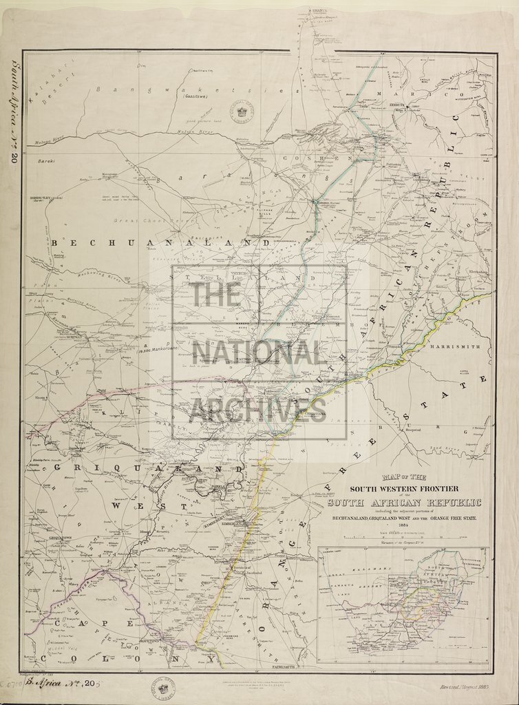
South Western frontier of South Africa
Date:
1884
Reference:
CO 700/SouthAfrica20
Creator:
Colonial Office, Commonwealth and Foreign and Commonwealth Offices, Empire Marketing Board, and related bodies
Catalogue context:
Map of the South-Western Frontier of the South African Republic, including the adjacent portions of Bechuanaland, Griqualand West, and the Orange Free State, 1884. 10 miles to 1 inch. Author, Publisher, &c.: War Office (No. 399) London
Categories:
Maps and plans; Overseas
Subjects:
International
Topics:
International trade and affairs; Land and buildings
Period:
Victorians
Places:
Africa
Copyright information:
Copyright clearance for publication is not required, except in the case of documents in third-party copyright.
Usage terms:
https://www.nationalarchives.gov.uk/documents/information-management/use-of-tna-materials.pdf