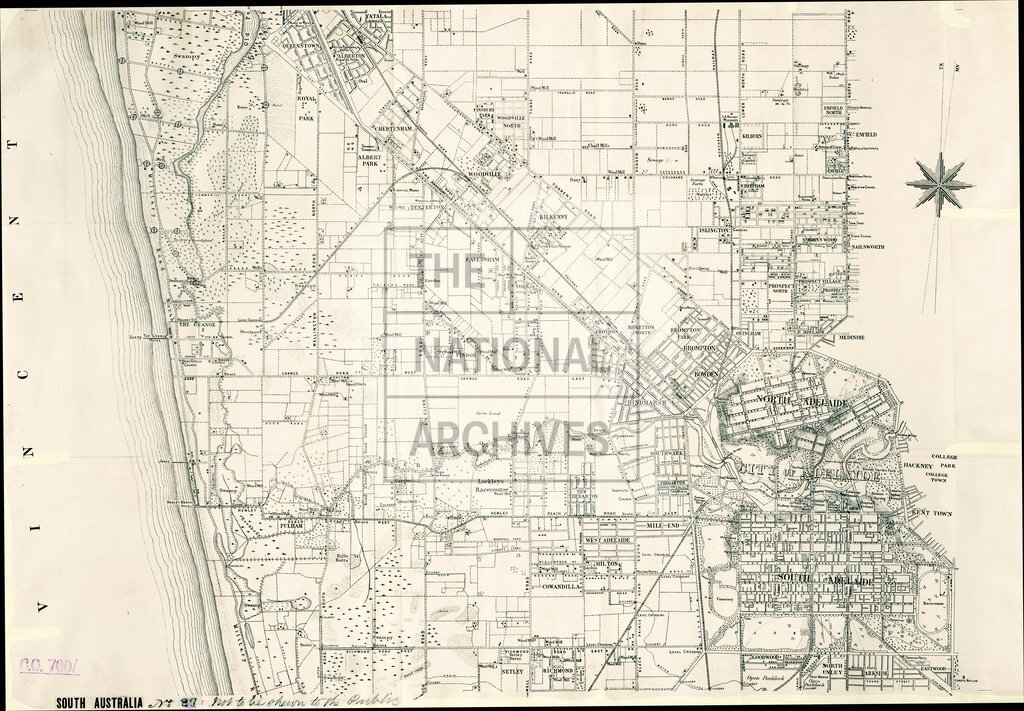
Military map of Adelaide, South Australia
Date:
1889
Reference:
CO 700/SouthAustralia37 (2 of 3)
Creator:
Colonial Office, Commonwealth and Foreign and Commonwealth Offices, Empire Marketing Board, and related bodies
Catalogue context:
Military Map of Adelaide and its immediate neighbourhood. Compiled in the Surveyor-General's Office, Adelaide, 1889. [For official use only.] 4 inches to 1 mile.
Categories:
Maps and plans; Overseas
Subjects:
Australia and Pacific; International; Maps and plans
Topics:
International trade and affairs; Land and buildings; Military and war
Period:
Victorians
Places:
Australia
Copyright information:
Copyright clearance for publication is not required, except in the case of documents in third-party copyright.
Usage terms:
https://www.nationalarchives.gov.uk/documents/information-management/use-of-tna-materials.pdf