Survey of Catawba Indian Land
Date:
1764
Reference:
CO 700/CAROLINA24
Creator:
Colonial Office, Commonwealth and Foreign and Commonwealth Offices, Empire Marketing Board, and related bodies
Catalogue context:
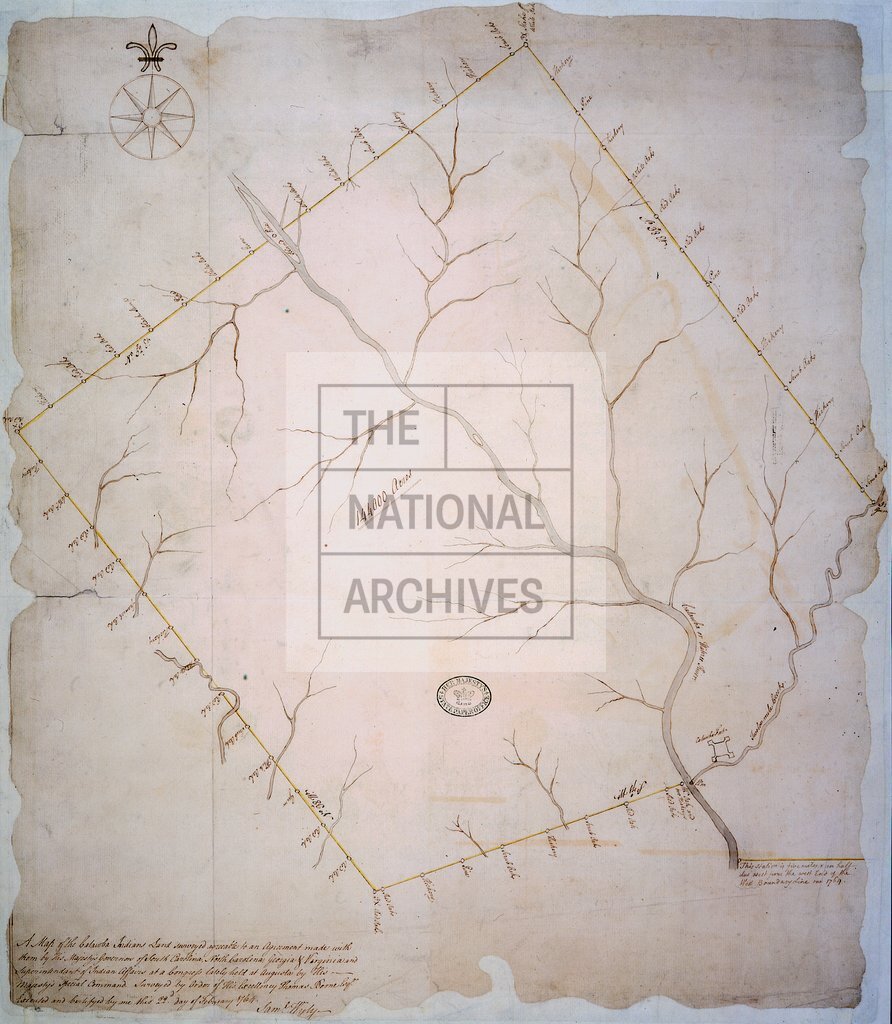
A Map of the Catawba Indians Land surveyed agreeable to an Agreement made with them by His Majesty's Governors of South Carolina, North Carolina, Georgia and Virginia, and Superintendent of Indian Affairs, at a Congress lately held at Augusta by His Majesty's special command. Surveyed by order of His Excellency, Thomas Boone, Esq. Executed and Certifyed by me this 22nd day of February, 1764. Saml. Wyly. [Augusta] MS.
Categories:
Maps and plans
Subjects:
Americas; Europe and Russia; International; Maps and plans
Topics:
International trade and affairs; Land and buildings
Period:
Empire And Industry
Copyright information:
Copyright clearance for publication is not required, except in the case of documents in third-party copyright.
Usage terms:
https://www.nationalarchives.gov.uk/documents/information-management/use-of-tna-materials.pdf