South Carolina and the Cherokee Indian Country boundary
Date:
1766
Reference:
CO 700/CAROLINA26
Creator:
Colonial Office, Commonwealth and Foreign and Commonwealth Offices, Empire Marketing Board, and related bodies
Catalogue context:
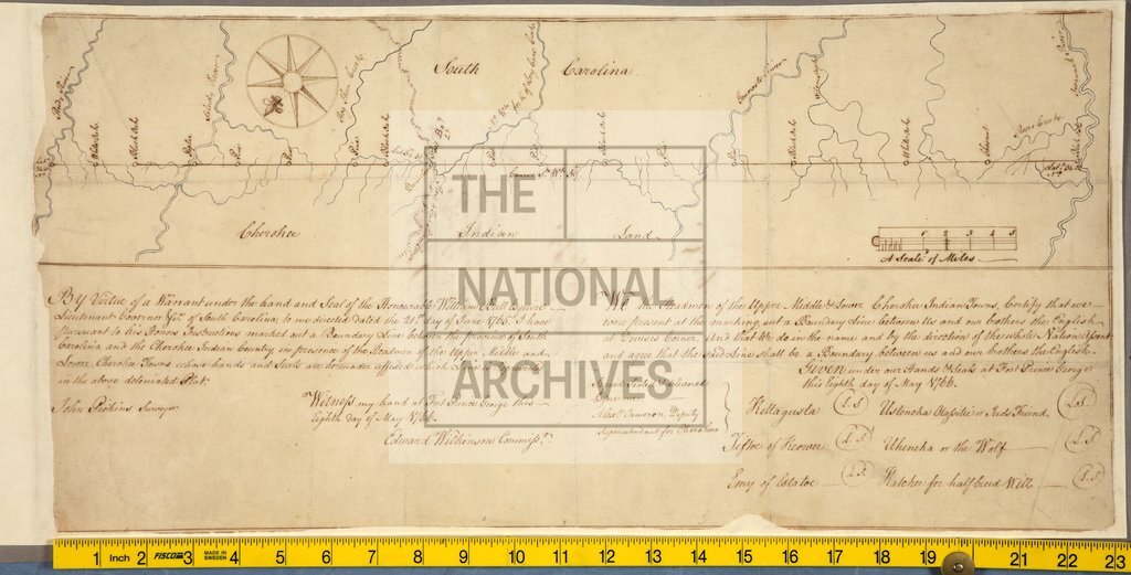
Boundary Line between the Province of South Carolina and the Cherokee Indian Country, marked out in presence of the Head Men of the Upper, Middle, and Lower Cherokee Towns, whose hands and seals are affixed. Done at Fort Prince George, 8th May, 1766. Edward Wilkinson, Commissioner, Fort Prince George. MS. 2 miles to 1 inch.
Categories:
Maps and plans
Subjects:
Americas; International; Maps and plans
Topics:
International trade and affairs; Land and buildings
Period:
Empire And Industry
Copyright information:
Copyright clearance for publication is not required, except in the case of documents in third-party copyright.
Usage terms:
https://www.nationalarchives.gov.uk/documents/information-management/use-of-tna-materials.pdf