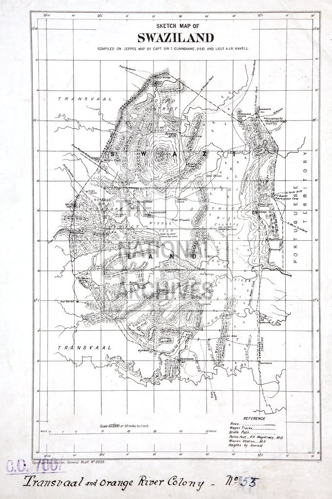
Sketch map of Swaziland
Date:
1905
Reference:
CO 700/TRANSVAAL55
Creator:
Colonial Office, Commonwealth and Foreign and Commonwealth Offices, Empire Marketing Board, and related bodies
Catalogue context:
Sketch map of Swaziland. Compiled on Jeppe's map by Capt. Sir T. Cunninghame, D.S.O., and Lieut. A. J. B. Wavell. 10 miles to 1 inch. Author, Publisher, &c.: War Office (No. 2035) London
Categories:
Maps and plans
Subjects:
Africa; Armed Forces (General Administration); Army; International; Maps and plans
Topics:
International trade and affairs; Land and buildings; Military and war
Period:
Early 20th Century
Copyright information:
Copyright clearance for publication is not required, except in the case of documents in third-party copyright.
Usage terms:
https://www.nationalarchives.gov.uk/documents/information-management/use-of-tna-materials.pdf