Northern Neck, Virginia
Date:
1747
Reference:
CO 700/VIRGINIA11
Creator:
Colonial Office, Commonwealth and Foreign and Commonwealth Offices, Empire Marketing Board, and related bodies
Catalogue context:
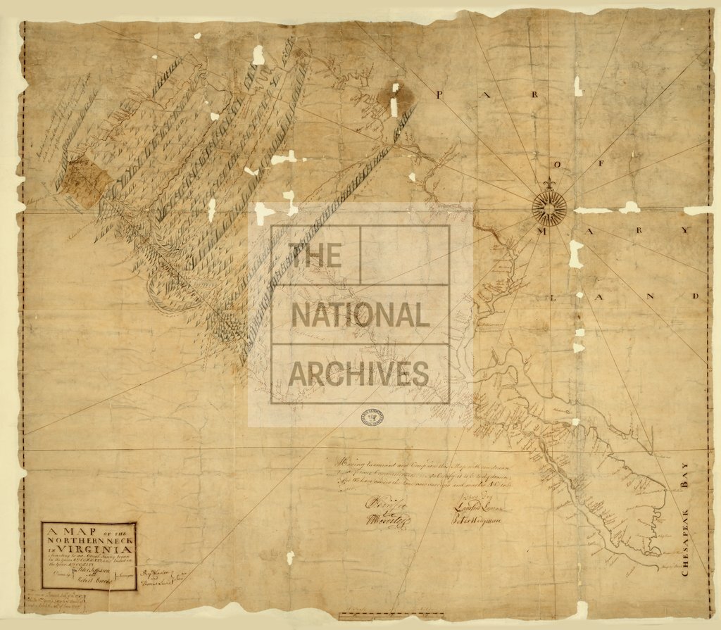
A Map of the Northern Neck in Virginia, according to an actual survey begun in 1736 and ended in 1746. Drawn by Peter Jefferson, Robert Brooke, Benjamin Winslow and Thomas Lewis, Surveyors. MS. 1 inch to 5 miles
Categories:
Maps and plans
Subjects:
Americas; International; Maps and plans
Topics:
International trade and affairs; Land and buildings
Period:
Early Modern
Copyright information:
Copyright clearance for publication is not required, except in the case of documents in third-party copyright.
Usage terms:
https://www.nationalarchives.gov.uk/documents/information-management/use-of-tna-materials.pdf