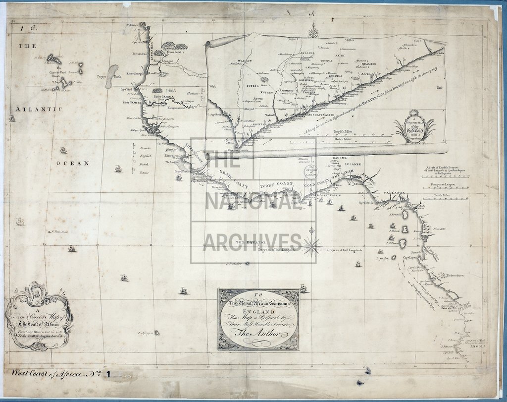
Coast of Africa, from Cape Blanco to Coast of Angola
Date:
1744
Reference:
CO 700/WestAfrica1 (1)
Creator:
Colonial Office, Commonwealth and Foreign and Commonwealth Offices, Empire Marketing Board, and related bodies
Catalogue context:
A new and correct Map of the Coast of Africa, from Cape Blanco, lat. 20° 40' N., to the Coast of Angola, lat. 11°S. [With a separate Map of the Gold Coast upon a larger scale. 20 miles to 1 inch.] About 120 miles to 1 inch.
Categories:
Maps and plans; Overseas
Subjects:
Africa; International; Maps and plans
Topics:
International trade and affairs; Land and buildings
Period:
Early Modern
Places:
Africa
Copyright information:
Copyright clearance for publication is not required, except in the case of documents in third-party copyright.
Usage terms:
https://www.nationalarchives.gov.uk/documents/information-management/use-of-tna-materials.pdf