Bights of Benin and Biafra, Africa
Date:
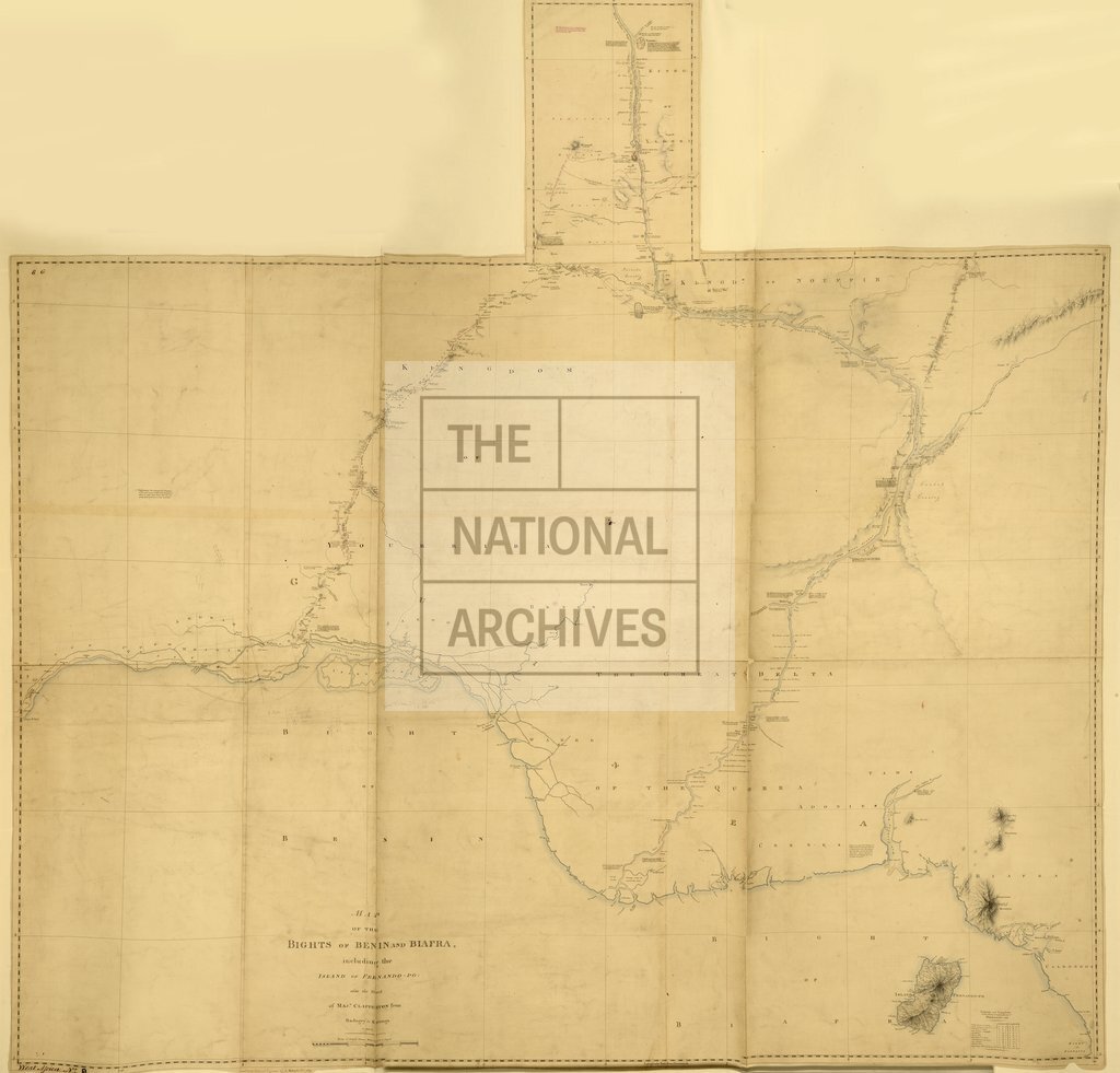
1829
Reference:
CO 700/WestAfrica9
Creator:
Colonial Office, Commonwealth and Foreign and Commonwealth Offices, Empire Marketing Board, and related bodies
Catalogue context:
Map of the Bights of Benin and Biafra, including the Island of Fernando Po: also the Track of Major Claperton from Badagry to Katunga in 1825-26. 9 miles to 1 inch. Author, Publisher, &c.: Hebert, L., London
Categories:
Maps and plans; Overseas
Subjects:
Africa; International; Maps and plans
Topics:
International trade and affairs; Land and buildings
Period:
Empire And Industry
Places:
Africa
Copyright information:
Copyright clearance for publication is not required, except in the case of documents in third-party copyright.
Usage terms:
https://www.nationalarchives.gov.uk/documents/information-management/use-of-tna-materials.pdf