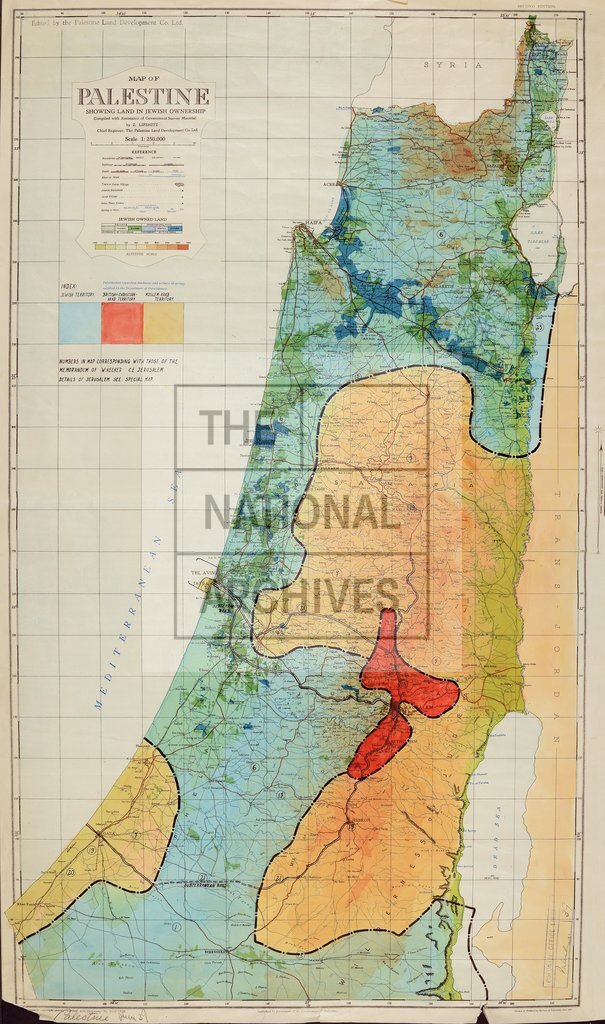
Palestine, land ownership
Date:
1924
Reference:
CO 1047/764 (2)
Creator:
Colonial Office, Commonwealth and Foreign and Commonwealth Offices, Empire Marketing Board, and related bodies
Catalogue context:
'Map of Palestine with Orographic Colouring'
Categories:
Maps and plans; Overseas
Subjects:
International
Topics:
International trade and affairs; Land and buildings
Period:
Interwar
Places:
Palestine
Copyright information:
Copyright clearance for publication is not required, except in the case of documents in third-party copyright.
Usage terms:
https://www.nationalarchives.gov.uk/documents/information-management/use-of-tna-materials.pdf