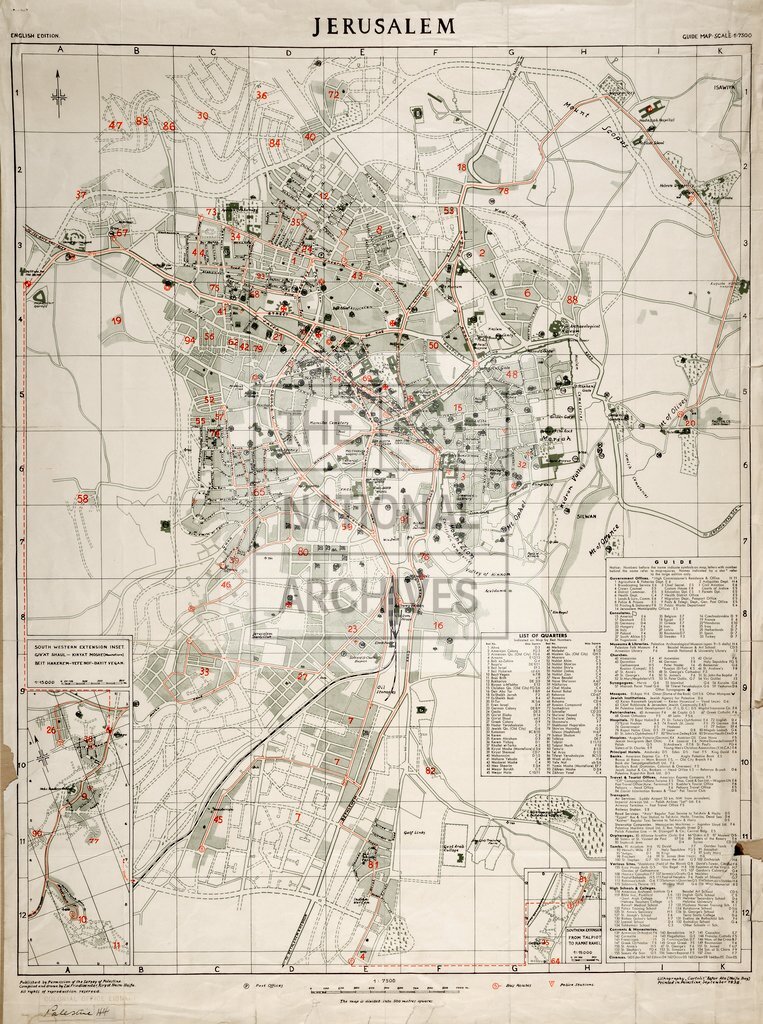
Jerusalem Guide Map
Date:
1938
Reference:
CO 1047/769 (1)
Creator:
Colonial Office, Commonwealth and Foreign and Commonwealth Offices, Empire Marketing Board, and related bodies
Catalogue context:
'Jerusalem. English Edition. Guide Map. Scale 1:7,500'. 'South Western Extension Inset. Giv'at Shaul-Kiryat Moshe (Montefiore). Beit Hakerem - Yefe Nof-Bayit Vegan', 1:15,000. Compiled and drawn by Zvi Friedlaender, Kiryat Haim-Haifa, lithographed by Cartolit, Kefar Ata (Haifa Bay). Reference tables to quarters and public buildings. 'List of Streets & Gates' on attached sheet
Categories:
Maps and plans
Subjects:
International
Topics:
International trade and affairs; Land and buildings
Period:
Interwar
Copyright information:
Copyright clearance for publication is not required, except in the case of documents in third-party copyright.
Usage terms:
https://www.nationalarchives.gov.uk/documents/information-management/use-of-tna-materials.pdf