Admiralty chart 1917 Vancouver Island and the Gulf of Georgia 1859
Date:
1859-1917
Reference:
FO 925/1383 p1
Creator:
Foreign Office
Catalogue context:
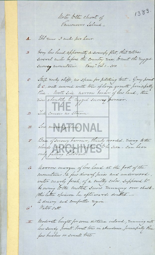
Admiralty chart 1917: 'Vancouver Island and the Gulf of Georgia from the surveys of Captain G. Vancouver R.N.1793, Captains D. Galiano and C. Valdes R.N.1792, Captain H Kellett R.N. 1847...' . Sections show profile of the country. Scale: 1 inch to about 16 miles. Compass indicators. Engraved by J & C Walker. Published 28 February 1849, with corrections to 1856. Manuscript reference table attached to the chart. Manuscript notes in red ink on topography and vegetation of the mainland from Admiralty Inlet to Jervis Inlet
Categories:
Maps and plans; Overseas
Subjects:
Armed Forces (General Administration); Europe and Russia; International; Maps and plans; Navy
Topics:
International trade and affairs; Land and buildings; Military and war
Period:
Victorians
Places:
Canada
Copyright information:
Copyright clearance for publication is not required, except in the case of documents in third-party copyright.
Usage terms:
https://www.nationalarchives.gov.uk/documents/information-management/use-of-tna-materials.pdf