Parish of Boconnoc, Cornwall
Date:
1838
Reference:
IR 30/6/11
Creator:
Boards of Stamps, Taxes, Excise, Stamps and Taxes, and Inland Revenue
Catalogue context:
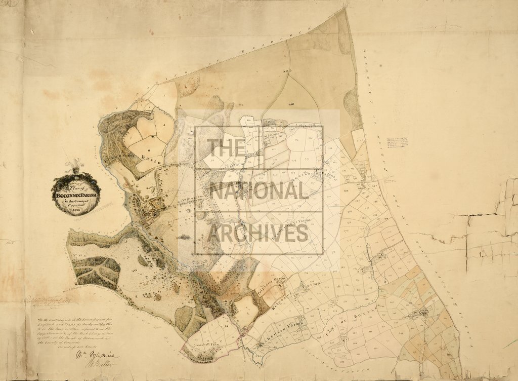
Tithe map of Boconnoc (parish), Cornwall. Shows manorial boundaries, named buildings, farms (named), gardens, orchards, bowling green, pheasantry, field names, farm acreages, hedges, fences, parkland (coloured), woods, footpath and/or bridleway, waterbodies, bridges. Decorative cartouche; fleur-de-lys and leaf border surround title. Scale: 1 inch to 6 chains
Categories:
Maps and plans
Subjects:
Tithe maps; England and Wales; Farming; Forestry; Manors; Maps and plans; Tithes
Topics:
Agriculture and environment; Business, finance and innovation; Land and buildings
Period:
Empire And Industry
Copyright information:
Copyright clearance for publication is not required, except in the case of documents in third-party copyright.
Usage terms:
https://www.nationalarchives.gov.uk/documents/information-management/use-of-tna-materials.pdf