Kenwyn Cornwall
Date:
1840
Reference:
IR 30/6/85
Creator:
Boards of Stamps, Taxes, Excise, Stamps and Taxes, and Inland Revenue
Catalogue context:
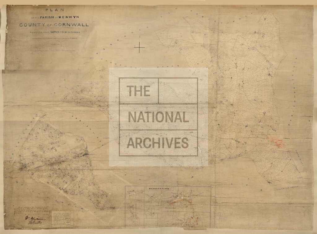
Tithe map of Kenwyn (parish), Cornwall. Shows manor boundary, quays, smelting house, named roads including turnpike roads. Scale: 1 inch to 8 chains; several enlargements are at 1 inch to 2 chains [1:1584]. Note on map; 'Compiled from surveys by R.Thomas, corrected etc by F.L. Turner under the directions of H.Baker'
Categories:
Maps and plans
Subjects:
Tithe maps; England and Wales; Manors; Maps and plans; Road transport; Tithes
Topics:
Business, finance and innovation; Land and buildings; Transport and travel
Period:
Empire And Industry
Copyright information:
Copyright clearance for publication is not required, except in the case of documents in third-party copyright.
Usage terms:
https://www.nationalarchives.gov.uk/documents/information-management/use-of-tna-materials.pdf