Bishop Wearmouth, Durham
Date:
1846
Reference:
IR 30/11/23 (2 of 2)
Creator:
Boards of Stamps, Taxes, Excise, Stamps and Taxes, and Inland Revenue
Catalogue context:
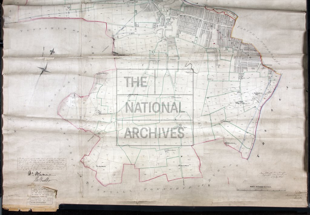
Tithe map of Bishop Wearmouth (except Barnes) (township in the parish of Bishop Wearmouth), County Durham. Shows buildings (generalised in built-up areas), woods, railway, quarry, hill-drawing, bridges. Colouring used. Scale: 1 inch to 4 chains. By Andrew Stoddart, South Shields
Categories:
Maps and plans
Subjects:
Tithe maps; England and Wales; Forestry; Maps and plans; Mining and quarrying; Railways; Tithes
Topics:
Agriculture and environment; Business, finance and innovation; Land and buildings; Transport and travel
Period:
Empire And Industry
Copyright information:
Copyright clearance for publication is not required, except in the case of documents in third-party copyright.
Usage terms:
https://www.nationalarchives.gov.uk/documents/information-management/use-of-tna-materials.pdf