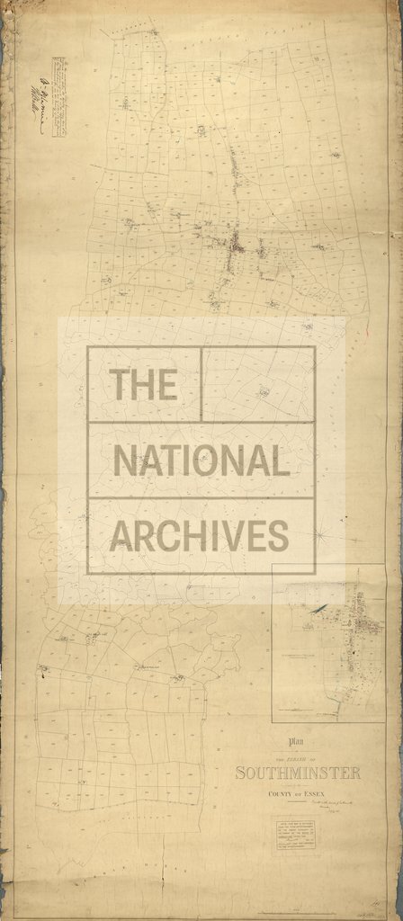
Southminster, Essex
Date:
1842
Reference:
IR 30/12/305
Creator:
Boards of Stamps, Taxes, Excise, Stamps and Taxes, and Inland Revenue
Catalogue context:
Tithe map of Southminster (parish), Essex. Shows buildings (named), vicarage, windmills, orchards, field boundary ownership, fences, field gates, named roads, footpath and/or bridleway, marsh (saltings), waterbodies, pump, embankment. Scale: 1 inch to 6 chains; village at 1 inch to 3 chains [1:2376]. By ? Walter J Ray
Categories:
Maps and plans
Subjects:
Tithe maps; England and Wales; Maps and plans; Tithes
Topics:
Business, finance and innovation; Land and buildings
Period:
Empire And Industry
Copyright information:
Copyright clearance for publication is not required, except in the case of documents in third-party copyright.
Usage terms:
https://www.nationalarchives.gov.uk/documents/information-management/use-of-tna-materials.pdf