Burrow in the parish of Tunstall, Lancashire
Date:
1849
Reference:
IR 30/18/55
Creator:
Boards of Stamps, Taxes, Excise, Stamps and Taxes, and Inland Revenue
Catalogue context:
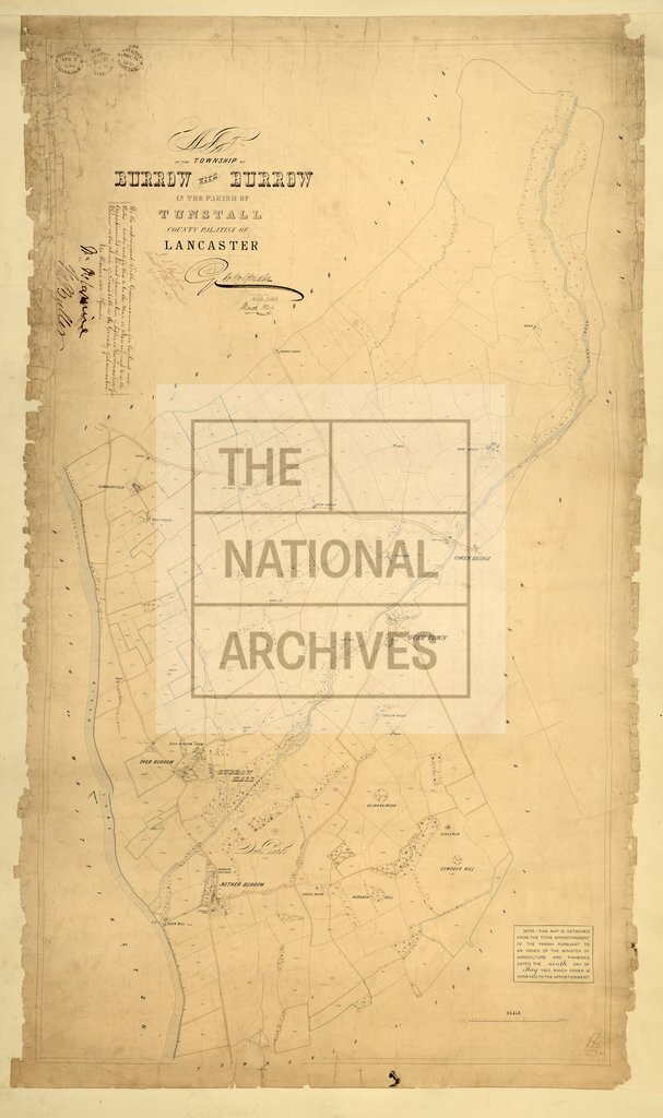
Tithe map of Burrow [Nether Burrow and Over Burrow] (township in the parish of Tunstall), Lancashire. Shows buildings (named), tithe barn, barns, corn mill, hedges, parkland (named), plantations, woods, waterbodies, ford, bridges. Colouring used. Scale: 1 inch to 6 chains. Map was 'corrected to the present date and copied' by George Wolfenden, Kirkby Lonsdale
Categories:
Maps and plans
Subjects:
Tithe maps; England and Wales; Farming; Forestry; Maps and plans; Tithes
Topics:
Agriculture and environment; Business, finance and innovation; Land and buildings
Period:
Empire And Industry
Copyright information:
Copyright clearance for publication is not required, except in the case of documents in third-party copyright.
Usage terms:
https://www.nationalarchives.gov.uk/documents/information-management/use-of-tna-materials.pdf