Friern Barnet, Middlesex
Date:
1845
Reference:
IR 30/21/16 (3 of 4)
Creator:
Boards of Stamps, Taxes, Excise, Stamps and Taxes, and Inland Revenue
Catalogue context:
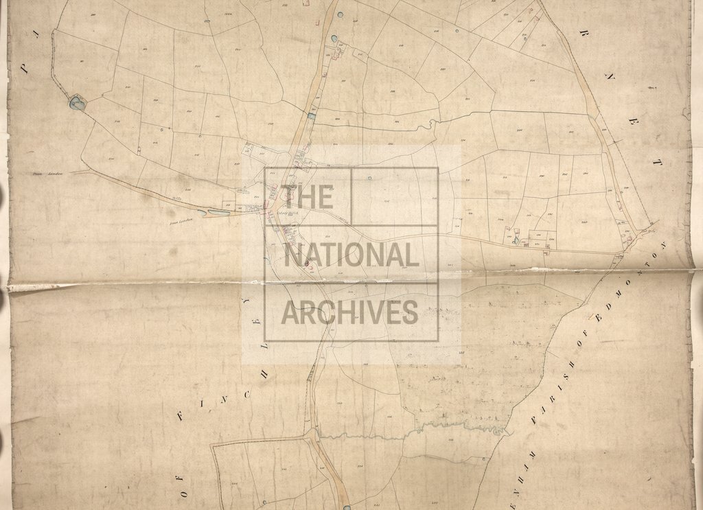
Tithe map of Friern Barnet (parish), Middlesex. Shows buildings (named), almshouses, orchards, woods, footpath and/or bridleway, waterbodies. Turnpike roads distinguished; toll house. Colouring used. Scale: 1 inch to 3 chains. By ? A Jack [? Jackson, name partly lost]
Categories:
Maps and plans
Subjects:
Tithe maps; England and Wales; Forestry; Maps and plans; Road transport; Tithes
Topics:
Agriculture and environment; Business, finance and innovation; Land and buildings; Transport and travel
Period:
Empire And Industry
Copyright information:
Copyright clearance for publication is not required, except in the case of documents in third-party copyright.
Usage terms:
https://www.nationalarchives.gov.uk/documents/information-management/use-of-tna-materials.pdf