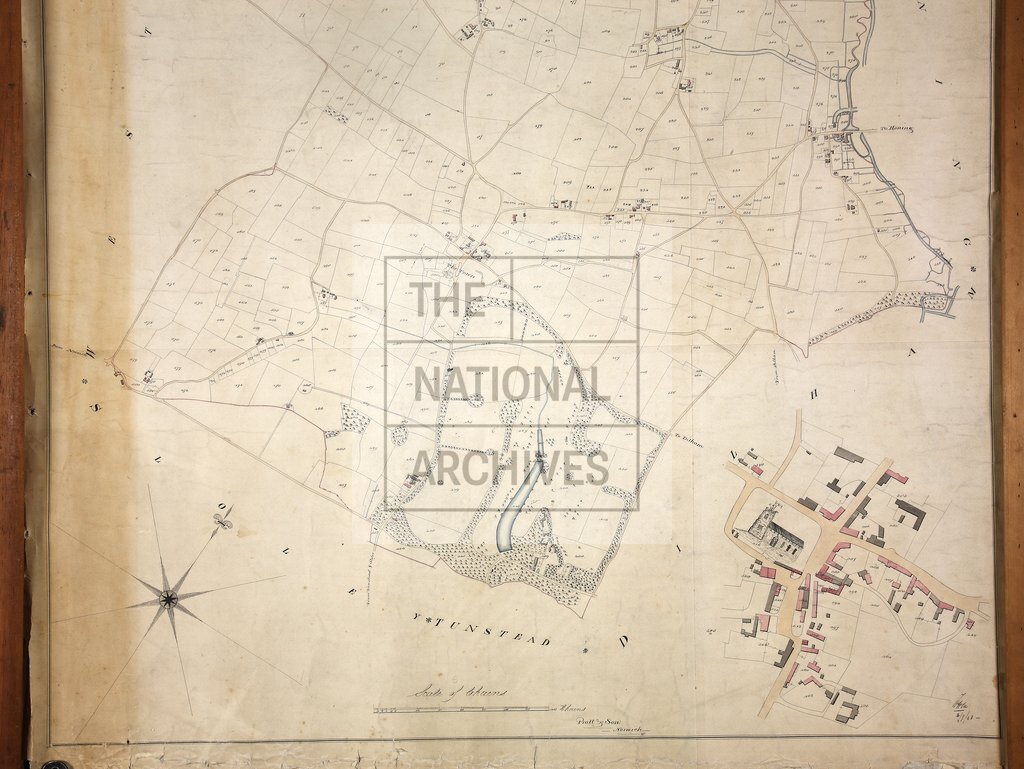
Tithe map of Worstead, Norfolk
Date:
1844
Reference:
IR 30/23/660 (1 of 2)
Creator:
Boards of Stamps, Taxes, Excise, Stamps and Taxes, and Inland Revenue
Catalogue context:
Tithe map of Worstead (parish), Norfolk. Shows buildings, church (pictorial), parkland, woods, waterbodies. Colouring used. Scale: 1 inch to 6 chains; village mapped separately at 1 inch to 1.5 chains [1:1188]. By Pratt and Son, Norwich
Categories:
Maps and plans
Subjects:
Tithe maps; England and Wales; Forestry; Maps and plans; Religions; Tithes
Topics:
Agriculture and environment; Business, finance and innovation; Land and buildings; Religion
Period:
Empire And Industry
Copyright information:
Copyright clearance for publication is not required, except in the case of documents in third-party copyright.
Usage terms:
https://www.nationalarchives.gov.uk/documents/information-management/use-of-tna-materials.pdf