Colton, Staffordshire
Date:
1845
Reference:
IR 30/32/71
Creator:
Boards of Stamps, Taxes, Excise, Stamps and Taxes, and Inland Revenue
Catalogue context:
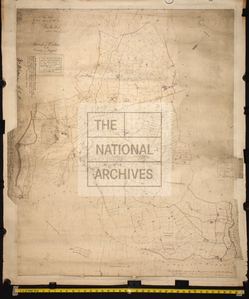
Tithe map of Colton (parish), Staffordshire (tithable parts only). Shows buildings (named), mills, woods, footpath and/or bridleway, waterbodies, bridges, aqueduct, canal with towpath, wharf. Colouring used. Scale: 1 inch to 6 chains; enlargement of detail at 1 inch to 3 chains [1:2376]
Categories:
Maps and plans
Subjects:
Tithe maps; England and Wales; Canals and river transport; Forestry; Maps and plans; Tithes
Topics:
Agriculture and environment; Business, finance and innovation; Land and buildings; Transport and travel
Period:
Empire And Industry
Copyright information:
Copyright clearance for publication is not required, except in the case of documents in third-party copyright.
Usage terms:
https://www.nationalarchives.gov.uk/documents/information-management/use-of-tna-materials.pdf