Flixton, Suffolk
Date:
1844
Reference:
IR 30/33/162
Creator:
Boards of Stamps, Taxes, Excise, Stamps and Taxes, and Inland Revenue
Catalogue context:
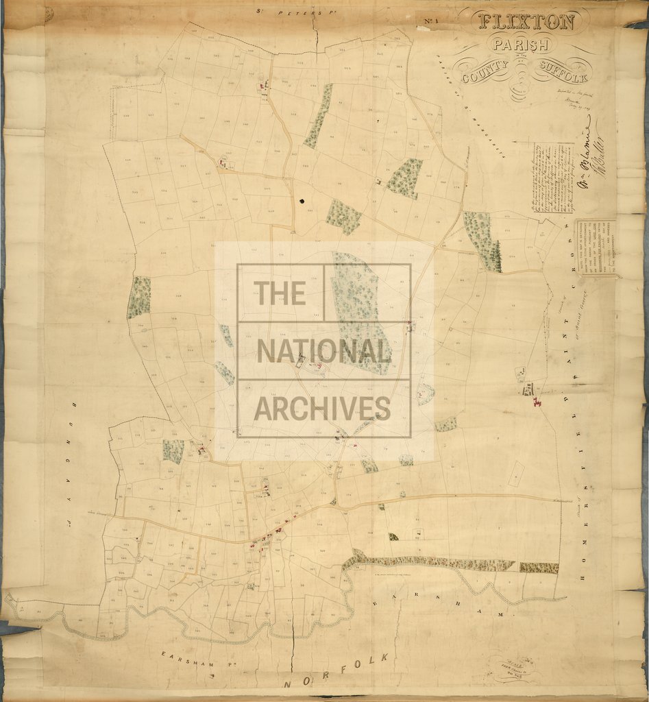
Tithe map of Flixton (parish), Suffolk. Shows disputed boundary, buildings, farmyards, woods (coloured), drains, waterbodies. Scale: 1 inch to 4 chains. First class map. By B H Galland, civil engineer
Categories:
Maps and plans
Subjects:
Tithe maps; England and Wales; Farming; Forestry; Maps and plans; Tithes
Topics:
Agriculture and environment; Business, finance and innovation; Land and buildings
Period:
Empire And Industry
Copyright information:
Copyright clearance for publication is not required, except in the case of documents in third-party copyright.
Usage terms:
https://www.nationalarchives.gov.uk/documents/information-management/use-of-tna-materials.pdf