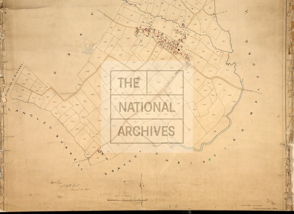
Sutton Benger Wiltshire
Date:
1839
Reference:
IR 30/38/254 (bottom half)
Creator:
Boards of Stamps, Taxes, Excise, Stamps and Taxes, and Inland Revenue
Catalogue context:
Tithe map of Sutton Benger (parish), Wiltshire. Shows buildings, pit, waterbodies. Colouring used. Scale: 1 inch to 6 chains. By R D Little, Chippenham
Categories:
Maps and plans
Subjects:
Tithe maps; England and Wales; Maps and plans; Tithes
Topics:
Business, finance and innovation; Land and buildings
Period:
Empire And Industry
Copyright information:
Copyright clearance for publication is not required, except in the case of documents in third-party copyright.
Usage terms:
https://www.nationalarchives.gov.uk/documents/information-management/use-of-tna-materials.pdf