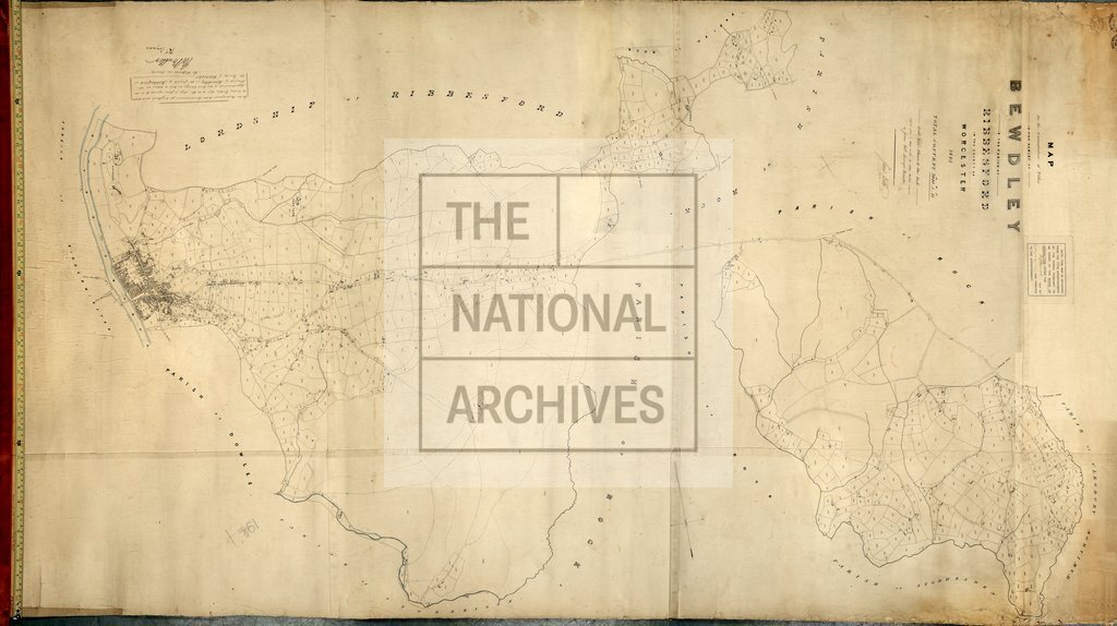
Bewdley, Worcestershire
Date:
1845
Reference:
IR 30/39/18
Creator:
Boards of Stamps, Taxes, Excise, Stamps and Taxes, and Inland Revenue
Catalogue context:
Tithe map of Bewdley (hamlet in the parish of Ribbesford), Worcestershire. Shows buildings (named), footpath and/or bridleway, waterbodies, bridges. Industrial land-use: snuff mill. Scale: 1 inch to 5 chains. Map was copied from a map made by John Walker and revised by James Webb, Worcester
Categories:
Maps and plans
Subjects:
Tithe maps; England and Wales; Maps and plans; Tithes
Topics:
Business, finance and innovation; Land and buildings
Period:
Empire And Industry
Copyright information:
Copyright clearance for publication is not required, except in the case of documents in third-party copyright.
Usage terms:
https://www.nationalarchives.gov.uk/documents/information-management/use-of-tna-materials.pdf