Carmarthen Town Plan
Date:
1838
Reference:
IR 30/47/5
Creator:
Boards of Stamps, Taxes, Excise, Stamps and Taxes, and Inland Revenue
Catalogue context:
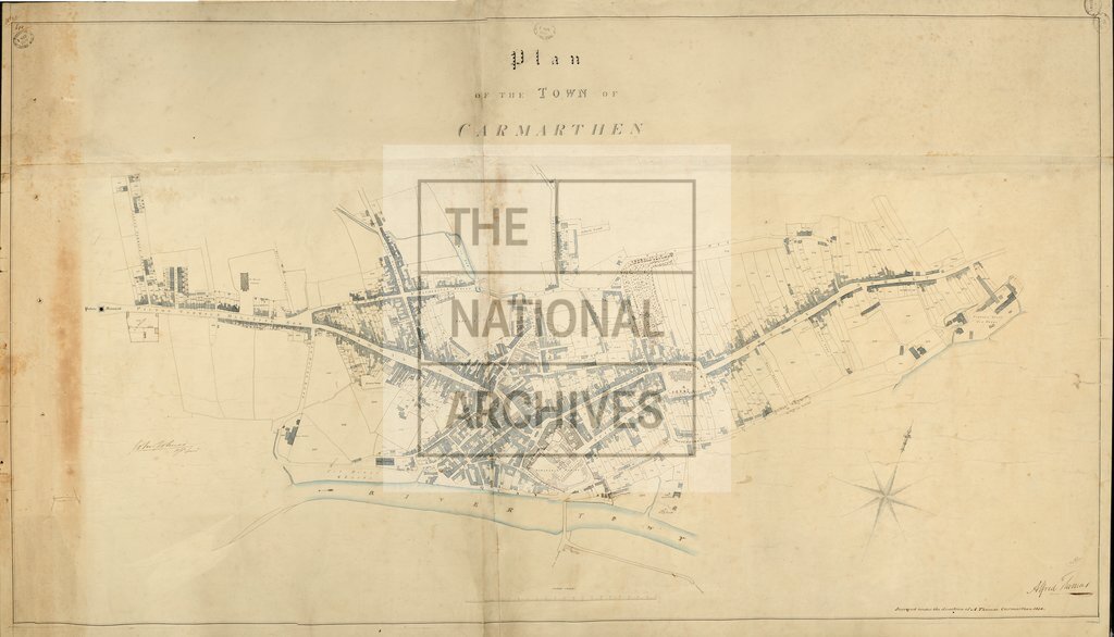
Tithe map of Carmarthen, St Peter [Carmarthen] (parish), Carmarthenshire. Shows buildings (named), chapel, tabernacle, workhouse, town hall, gaols (one annotated with type of inmate eg male debtors), monument, gardens, graveyards, woods, hill-drawing, named roads, waterbodies, rock outcrops, antiquities (priory). Industrial land-use: quarries, gas works, tin works, furnace mills, brick yards, lime kiln, old pottery. Colouring used. Decorative border. Scale: 1 inch to 6 chains; enlargement of town at 1 inch to 3 chains [1:2376]. By Alfred Thomas, Carmarthen
Categories:
Maps and plans
Subjects:
Tithe maps; England and Wales; Forestry; Maps and plans; Mining and quarrying; Oil and gas; Poverty; Religions; Tithes
Topics:
Agriculture and environment; Business, finance and innovation; Health and welfare; Land and buildings; Religion
Period:
Empire And Industry
Copyright information:
Copyright clearance for publication is not required, except in the case of documents in third-party copyright.
Usage terms:
https://www.nationalarchives.gov.uk/documents/information-management/use-of-tna-materials.pdf