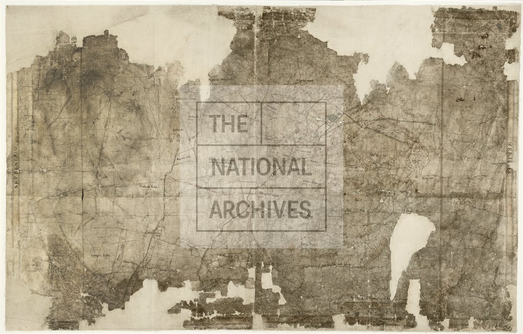
Hailes, Gloucestershire, by Ralph Treswell
Date:
1587
Reference:
MF 1/59
Creator:
Maps and plans extracted to flat storage from records of various departments
Catalogue context:
1 item extracted from E 178/910 . Map of Hailes, Gloucestershire, and surrounding area, showing Hailes manor house, mill, inn, dovecote and other farm buildings of the dissolved abbey. Also shows houses and church at Didbrook; named fields and closes with acreage, some fields shown in strips with bulkheads; hedges, hedge trees, stiles and gates; roads, woods, streams, ponds (one with swan), and lead conduit. Border. Scale bar surmounted by dividers, bearing legend 'A Scale of Perches at 16 foot to the perc[h]': scale bar damaged. Cardinal points: oriented to the east. Signed by Ralph Treswell and dated by him 158[-]. Blank panels at the sides of the map also suggest that the map is unfinished. Annotations in a different hand note features named in the dispute for which the map was made, and give land use at that time. Produced by order of a special commission of inquiry dated 1587 (E 178/910 folio 2), into ownership of Hailes Park. A further commission of that year noted that a map had been made and agree...
Categories:
Maps and plans
Subjects:
Archives and libraries; Forestry; Manors; Maps and plans; Religions
Topics:
Agriculture and environment; Land and buildings; Religion
Period:
Early Modern
Copyright information:
Copyright clearance for publication is not required, except in the case of documents in third-party copyright.
Usage terms:
https://www.nationalarchives.gov.uk/documents/information-management/use-of-tna-materials.pdf