Vilayet of the Danube
Date:
1869
Reference:
MFQ 1/351
Creator:
Maps and plans extracted to flat storage from records of various departments held at the Public Record Office, Kew
Catalogue context:
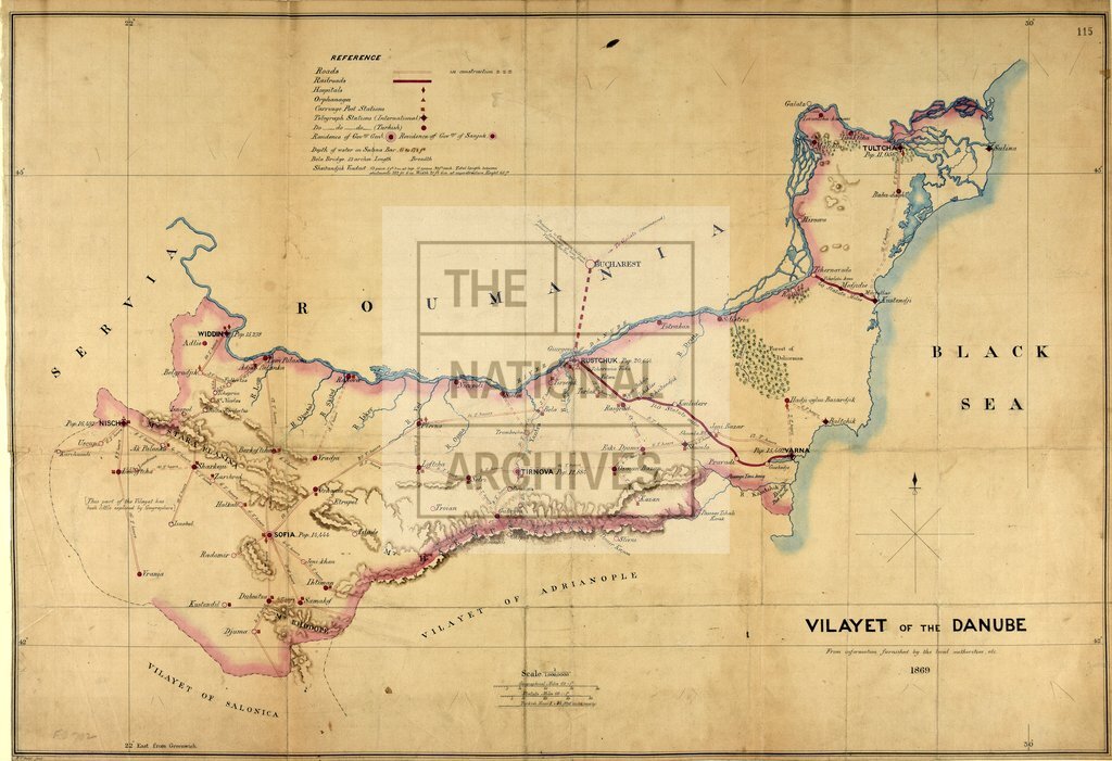
1 item (originally illustrating general report on the vilayet by Sir R Dalyell, March 1869) extracted from FO 78/2089 . South-east Europe: Ottoman Empire. 'Vilayet of the Danube from information furnished by the local authorities, etc.1869': map (of territory now in Bulgaria and Romania) showing roads, railways, hospitals, orphanages, telegraph stations, and official residences etc. Reference table. Scale erroneously given as '1:1,000,0000'. Compass indicator.
Categories:
Maps and plans
Subjects:
Archives and libraries; Communications; Europe and Russia; Maps and plans; Middle East; Railways
Topics:
Arts and culture; International trade and affairs; Land and buildings; Transport and travel
Period:
Victorians
Copyright information:
Copyright clearance for publication is not required, except in the case of documents in third-party copyright.
Usage terms:
https://www.nationalarchives.gov.uk/documents/information-management/use-of-tna-materials.pdf