Bute Inlet and Fraser River routes from the mouth of the Quesnel River to Victoria on Vancouver Island, British Columbia
Date:
1865
Reference:
MPG 1/649
Creator:
Maps and plans extracted to flat storage from records of the Colonial Office
Catalogue context:
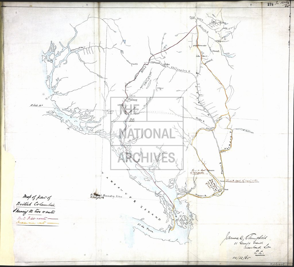
1 item extracted from CO 60/23 (folio 278). Map of part of British Columbia, showing the Bute Inlet and Fraser River routes from the mouth of the Quesnel River to Victoria on Vancouver Island, showing place names, rivers, and notes on navigation. Signed by James D Churchill, 11 George Yard, Lombard St, EC, 14 December 1865.
Categories:
Maps and plans; Overseas
Subjects:
Archives and libraries; International; Maps and plans
Topics:
International trade and affairs; Land and buildings
Period:
Victorians
Places:
Canada
Copyright information:
Copyright clearance for publication is not required, except in the case of documents in third-party copyright.
Usage terms:
https://www.nationalarchives.gov.uk/documents/information-management/use-of-tna-materials.pdf