British Columbia, trails and routes of communication
Date:
1860
Reference:
MPG 1/657
Creator:
Maps and plans extracted to flat storage from records of the Colonial Office
Catalogue context:
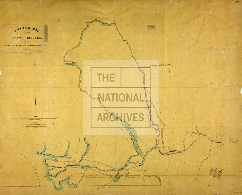
1 item extracted from CO 60/7 (folio 360). 'Sketch Map of Part of British Columbia shewing Trails and Routes of Communication'. Map showing trails between New Westminster, Hope, Vermilion, Lytton and Lakes Harrison, Lillooet, Anderson and Seton. Reference table to trails. Scale: 1 inch to 5 miles. Compass indicator. Prepared at the Royal Engineers Survey Office, New Westminster. Traced by J Launders, Sapper RE. Signed by R C Moody, Col RE.
Categories:
Maps and plans
Subjects:
Archives and libraries; Army; International; Maps and plans
Topics:
International trade and affairs; Land and buildings; Military and war
Period:
Victorians
Copyright information:
Copyright clearance for publication is not required, except in the case of documents in third-party copyright.
Usage terms:
https://www.nationalarchives.gov.uk/documents/information-management/use-of-tna-materials.pdf