Sketch of security arrangements at Eagle Hawk Neck, Van Diemen's Land, c.
Date:
1832
Reference:
MPG 1/689 (4)
Creator:
Maps and plans extracted to flat storage from records of the Colonial Office
Catalogue context:
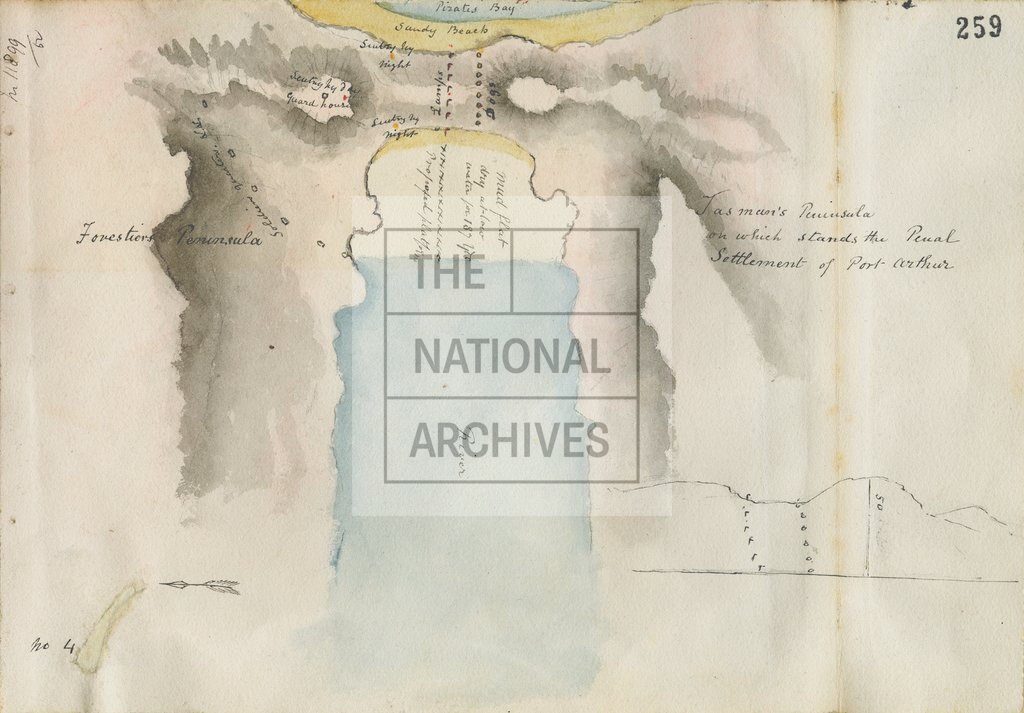
4 items (enclosures to despatch number 177 of 28 August 1852) extracted from CO 280/293 (folios 254, 256, 258, 259). Van Diemen's Land (now Tasmania): (1) 'Eagle Hawk Neck, from Tasman's Peninsula, on which stands Port Arthur.' Charcoal sketch showing wooded country, buildings etc. and, in the foreground, a sentry box, a line of lamps, large dogs chained to kennels in the charge of a guard. No scale shown. (2) 'Van Diemens Land divided into electoral districts'. Reference table identifying Hobart, Port Arthur, Eagle Hawk Neck and other townships. No scale shown. Compass indicator. (3) Watercolour view of Eagle Hawk Neck. (4) Watercolour sketch map of Tasman's Peninsula and Eagle Hawk Neck, showing positions of sentries etc. No scale shown. Dimensions of sheets: (1) 19.5 cm x 28.5 cm; (2) 44.5 cm x 34 cm; (3) 17.5 cm x 25.5 cm; (4) 17.5 cm x 25.5 cm.
Categories:
Maps and plans
Subjects:
Archives and libraries; Art, architecture and design; Australia and Pacific; Coal; International; Maps and plans
Topics:
Arts and culture; Business, finance and innovation; International trade and affairs; Land and buildings
Period:
Empire And Industry
Copyright information:
Copyright clearance for publication is not required, except in the case of documents in third-party copyright.
Usage terms:
https://www.nationalarchives.gov.uk/documents/information-management/use-of-tna-materials.pdf