Malay Peninsula
Date:
1889
Reference:
MPG 1/771
Creator:
Maps and plans extracted to flat storage from records of the Colonial Office
Catalogue context:
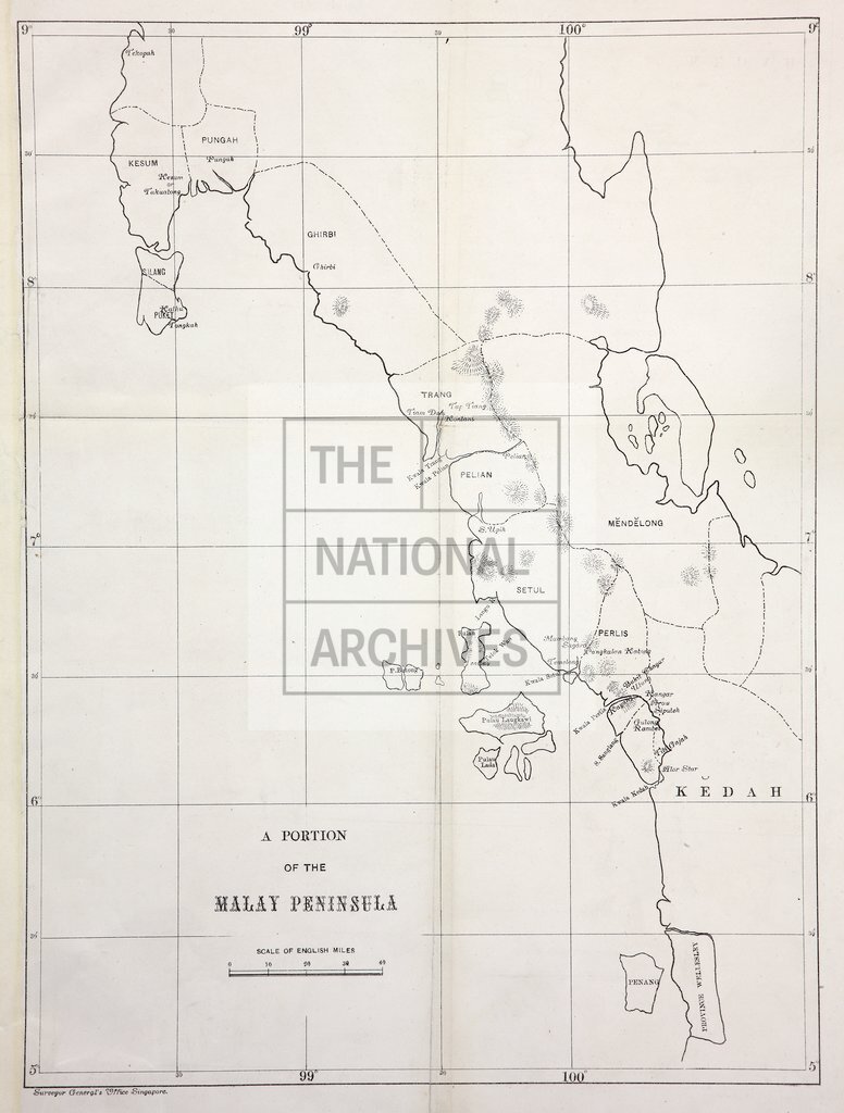
1 item (originally filed with despatch number 221 of 17 May 1889) extracted from CO 273/160 . 'A Portion of the Malay Peninsula.' Outline map showing coastal area between 5°N and 9°N (Penang (now in Malaysia) to Tekopah, Thailand). Scale: 1 inch to 16 miles. Printed at the Surveyor General's Office, Singapore.
Categories:
Maps and plans
Subjects:
Archives and libraries; Asia; International; Maps and plans
Topics:
International trade and affairs; Land and buildings
Period:
Victorians
Copyright information:
Copyright clearance for publication is not required, except in the case of documents in third-party copyright.
Usage terms:
https://www.nationalarchives.gov.uk/documents/information-management/use-of-tna-materials.pdf